

jeudi, 23 février 2017
Discussion with Keith Preston on Pan-Secession
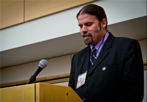
Discussion with Keith Preston on Pan-Secession
22:16 Publié dans Actualité | Lien permanent | Commentaires (0) | Tags : keith preston, actualité, états-unis, sécessionisme, sécession, amérique, amérique du nord |  |
|  del.icio.us |
  |
|  Digg |
  Facebook
Sid Lukkassen over Avondland en Identiteit
Sid Lukkassen over Avondland en Identiteit in Batavieren Podcast aflevering 19
22:07 Publié dans Actualité | Lien permanent | Commentaires (0) | Tags : actualité, civilisation occidentale, occident, identité, sid lukkassen, pays-bas, philosophie | | del.icio.us | | Digg | Facebook
Jorge Verstrynge: Siempre me fascinó el Nacional-Bolchevismo

Jorge Verstrynge: Siempre me fascinó el Nacional-Bolchevismo
21:59 Publié dans Actualité, Entretiens | Lien permanent | Commentaires (0) | Tags : actualité, entretien, jorge verstrynge, espagne, national-bolchevisme | | del.icio.us | | Digg | Facebook
Zur Nietzsche-Rezeption Arthur Moeller van den Brucks

Armin Thomas Müller: Zur Nietzsche-Rezeption Arthur Moeller van den Brucks
21:00 Publié dans Philosophie, Révolution conservatrice | Lien permanent | Commentaires (0) | Tags : philosophie, friedrich nietzsche, arthur moeller van den bruck, révolution conservatrice, allemagne | | del.icio.us | | Digg | Facebook