Ok

En poursuivant votre navigation sur ce site, vous acceptez l'utilisation de cookies. Ces derniers assurent le bon fonctionnement de nos services. En savoir plus.

jeudi, 23 mai 2019

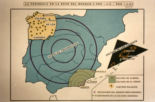
Pastores esteparios de Europa del Este reemplazaron al 100% de los hombres ibéricos hace 4.000 años

iberiabronce3.jpg

La influencia genética de las estepas fue también muy fuerte en el País Vasco

Pastores esteparios de Europa del Este reemplazaron al 100% de los hombres ibéricos hace 4.000 años

Ex: https://latribunadelpaisvasco.com

Un estudio internacional coliderado por el Consejo Superior de Investigaciones Científicas (CSIC) y la Universidad de Harvard (Estados Unidos) ha elaborado un mapa genético de la península Ibérica que abarca los últimos 8.000 años. El estudio, publicado en la revista Science, ha analizado los genomas de 271 habitantes de la Península de diferentes épocas históricas y los ha contrastado con los datos recogidos en estudios previos de otros 1.107 individuos antiguos y de 2.862 modernos. Los resultados muestran una imagen inédita hasta el momento de la transformación  de la población ibérica a lo largo de las diferentes etapas históricas y prehistóricas.

Reemplazo de la población masculina en la Edad del Bronce

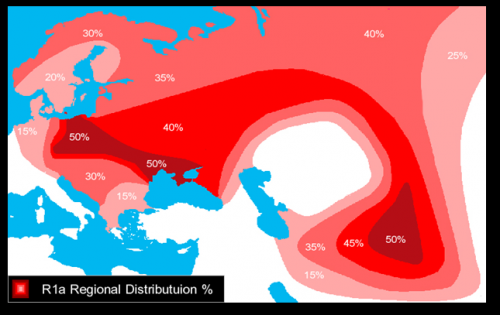
La llegada de grupos descendientes de pastores de las estepas de Europa del Este hace entre 4.000 y 4.500 años supuso el reemplazo de aproximadamente el 40% de la población local y de casi el 100% de los hombres. “Los resultados genéticos son muy claros en este aspecto. De forma progresiva durante una etapa que pudo durar unos 400 años, los linajes del cromosoma Y presentes hasta entonces en la Iberia de finales del Neolítico fueron casi totalmente sustituidos por un linaje, R1b-M269, de ascendencia esteparia”, explica el científico del CSIC Carles Lalueza-Fox, del Instituto de Biología Evolutiva (centro mixto del CSIC y la Universidad Pompeu Fabra).

“Si bien este fue claramente un proceso dramático, los datos genéticos por sí solos no nos pueden decir qué lo impulsó", añade David Reich, investigador en la Escuela de Medicina de Harvard y corresponsable del estudio. "Sería un error afirmar que la población local fue desplazada, puesto que no hay evidencia de violencia generalizada en ese periodo”, añade por su parte Íñigo Olalde, investigador de la Universidad de Harvard. Según Lalueza-Fox, una explicación alternativa sería que las mujeres ibéricas locales prefirieran a los recién llegados de Europa central en un contexto de “fuerte estratificación social”.

El equipo de investigación destaca que los datos genéticos por sí solos no revelarán toda la historia. “Las evidencias de otros campos, como la arqueología y la antropología, deben ser conjugados con estos resultados para comprender mejor qué impulsó este patrón genético”, sentencia Reich.

Como ejemplo de este fenómeno de reemplazo, el estudio documenta una tumba encontrada en un yacimiento de la Edad del Bronce en la localidad de Castillejo del Bonete (Ciudad Real). De los dos individuos hallados en el enterramiento, el hombre presenta ascendencia de la estepa, mientras que la mujer es genéticamente similar a los ibéricos anteriores al Neolítico tardío.  

Genética vasca

Otra de las principales conclusiones del estudio es que la genética de los vascos actuales apenas ha cambiado desde la Edad del Hierro (hace unos 3.000 años). Al contrario de lo que apuntan algunas teorías que situaban a los vascos como los descendientes de cazadores mesolíticos o de los primeros agricultores que vivieron en la península Ibérica, los resultados de este trabajo muestran que la influencia genética de las estepas también llegó al País Vasco (de hecho tienen una de las frecuencias más altas del cromosoma Y R1b). Por el contrario, apenas presentan influencias de migraciones posteriores como los romanos, los griegos o los musulmanes, de las que quedaron aislados.

“Ahora se piensa que las lenguas indoeuropeas se extendieron por Europa de mano de los descendientes de los pueblos de las estepas. En este estudio mostramos las complejidades de la península Ibérica, donde hay paleolenguas de tipo indoeuropeo, como el celtíbero, y no indoeuropeas, como el íbero, así como el euskera, que es la única lengua preindoeuropea de Europa todavía hablada. Nuestros resultados indican un mayor componente de las estepas en celtíberos que en íberos; pero en todo caso hay una cierta disociación entre lengua y ancestralidad”, añade Lalueza-Fox.

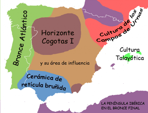
iberica-Bronce_Final.png

Contactos africanos

La distribución de la corriente genética desde África hacia la Península es mucho más antigua de lo documentado hasta el momento. El estudio registra la presencia en el centro de la península Ibérica, en el yacimiento de Camino de las Yeseras (Madrid), de un individuo procedente del norte de África que vivió hace unos 4.000 años, así como de un nieto de emigrante africano en un yacimiento gaditano de la misma época. Ambos individuos portaban considerables proporciones de ancestralidad subsahariana. Sin embargo, se trata de contactos esporádicos que dejaron poca huella genética en las poblaciones ibéricas de la Edad del Cobre y del Bronce.

Además, los resultados indican que hubo flujo génico norteafricano en el sureste de la Península en época púnica y romana, mucho antes de la llegada de los musulmanes a la Península en el siglo VIII.

Romanos, griegos, fenicios, visigodos y musulmanes

El análisis del mapa genético muestra profundas modificaciones de población en la península Ibérica en periodos históricos más recientes. “Documentamos por primera vez el impacto genético de estos grandes acontecimientos. Los resultados muestran que para cuando comenzó la Edad Media al menos un cuarto de la ancestralidad ibérica había sido reemplazada por nuevos flujos de población provenientes del Mediterráneo oriental (romanos, griegos y fenicios), lo que revela que las migraciones durante este periodo seguían teniendo una gran fuerza en la formación de la población mediterránea”, explica el investigador Olalde.

Uno de los ejemplos de este fenómeno mencionados en el trabajo es la colonia griega de Ampurias, en el noreste peninsular, entre los años 600 antes de nuestra era y el periodo tardorromano. Los 24 individuos analizados se dividen en dos grupos de herencia genética distinta: uno compuesto por individuos con una ancestralidad típica griega y otro compuesto por población genéticamente indistinguible de los íberos del cercano poblado de Ullastret.

“El artículo analiza también la llegada a la Península de los visigodos y los musulmanes. Entre los primeros se han localizado dos individuos en el yacimiento de Pla de l’Horta (Girona) con clara ancestralidad del este de Europa y un ADN mitocondrial típico de Asia. Del periodo islámico se han analizado individuos de Granada, Valencia, Castellón y Vinaroz, que muestran un componente norteafricano cercano al 50%, mucho mayor que el residual 5% que se observa en la población ibérica actual. En este caso se trata de una ancestralidad que fue casi eliminada durante la Reconquista y la posterior expulsión de los moriscos”, comenta Lalueza-Fox.

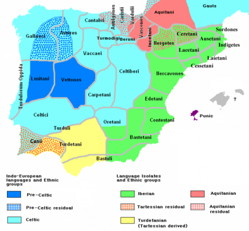
iberia_200_BCE.PNG

Estructura de la población de la Iberia Mesolítica

Este estudio, junto con otro publicado el mismo día en Current Biology, identifica por primera vez la presencia de una estructura genética espacial y temporal entre los cazadores recolectores de la península Ibérica durante el Mesolítico (hace aproximadamente 8.000 años). En el noroeste, los cazadores mesolíticos que vivieron pocos siglos antes de la llegada de los primeros agricultores muestran una afinidad genética con los cazadores recolectores centroeuropeos. Esa ancestralidad no estaba presente en los anteriores cazadores recolectores de esa misma región ni en los cazadores recolectores contemporáneos del sureste de Iberia a finales del Mesolítico.

lundi, 06 mai 2019

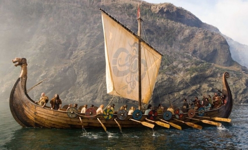
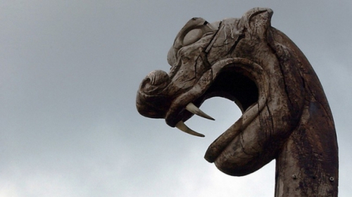
Viking Ship Tradition

longship09.jpg

Viking Ship Tradition

09:41 Publié dans archéologie | Lien permanent | Commentaires (0) | Tags : marine, vikings, scandinavie, archéologie, drakkars | |  del.icio.us | | Digg! Digg |  Facebook

samedi, 16 mars 2019

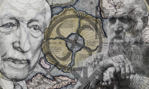
La théorie civilisationnelle d’Herman Wirth

wirth.png

La théorie civilisationnelle d’Herman Wirth

Alexandre Douguine                                  

Le Cercle Culturel de Thulé

L’idée de Bachofen d’un matriarcat primordial et sa théorie des « cercles culturels » furent  développés par un autre historien et archéologue, un spécialiste en paléo-épigraphie, Herman Wirth (1885-1981).

Les théories de Wirth sont basées sur l’hypothèse empruntée à l’auteur indien Bala Gandhara Tilak (1856-1920) [1], selon qui la civilisation proto-indo-européenne originelle se forma à la fin du Paléolithique (la culture aurignacienne) dans la région du cercle polaire nordique. Cette  hypothèse était basée sur l’interprétation des données de l’astrologie indienne, des textes védiques, et des mythes des Hindous, des Iraniens et des Grecs, qui parlent de l’existence dans l’antiquité lointaine d’un pays habité se trouvant dans le Grand Nord (Hyperborée). Ce continent étai décrit dans les Vedas comme la « terre du sanglier blanc », Varahi, et l’« île de  lumière », ou Sweta Dvipa. La tradition zoroastrienne parle de l’ancienne résidence du premier homme, la cité de Vara, située dans le Grand Nord, qu’il fut forcé de quitter pour descendre  vers le sud quand la déité obscure Angra Mainyu, l’ennemi du dieu de la lumière  Ahura-Mazda, déchaîna un « grand froid » sur cette contrée. Tilak affirme l’existence de cette proto-civilisation « nordique » sur la base de l’astrologie indienne, dont le symbolisme, selon Tilak, ne devient clair que si nous acceptons que les constellations furent originellement observées dans les régions circumpolaires, où le jour des dieux est égal à l’année des hommes.
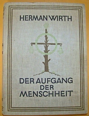
wirthaufgang.jpgWirth adopta cette hypothèse et construisit sa propre théorie sur elle, la « théorie hyperboréenne » [2] ou théorie du « cercle culturel de Thulé » [3], qui est le nom grec de la cité mythique se trouvant dans le pays des Hyperboréens. D’après cette théorie, avant la dernière vague de refroidissement mondial, la zone circumpolaire dans l’Océan nord-atlantique abritait des terres habitables dont les habitants furent les créateurs d’un code culturel primordial. Cette culture se forma dans des conditions où l’environnement naturel de l’Arctique n’était pas encore si inhospitalier, et où son climat était similaire au climat tempéré de l’Europe Centrale moderne. Cependant, étaient présents tous les phénomènes annuels et atmosphériques qui peuvent être observés dans l’Arctique aujourd’hui : le jour et la nuit arctiques. Les cycles solaire et lunaire annuels sont structurés différemment de leurs équivalents sous les latitudes moyennes. Ainsi, les fixations symboliques du calendrier, la trajectoire du soleil, de la lune et les constellations du zodiaque avaient forcément une forme différente et des motifs différents.

A partir d’une énorme quantité de matériel archéologique, paléo-épigraphique (peintures rupestres, symboles paléolithiques, anciennes gravures, etc.), mythologique et philologique, Herman Wirth tenta de reconstruire le système primordial du code culturel de cette proto-civilisation arctique. Au cœur de celui-ci il plaça le proto-calendrier reconstruit, dont les  dernières traces sont constituées d’après Wirth par les runes scandinaves, qu’il attribuait à l’antiquité éloignée. Wirth proposa d’examiner ce calendrier, qui enregistre les moments clés de l’année arctique, comme étant la clé de toutes les versions ultérieures des héritages mythologiques, religieux, ritualistes, artistiques et philosophiques qui continuèrent et développèrent cet algorithme primordial au cours des vagues de migrations des porteurs de la « culture thuléenne » dans les régions méridionales. Lorsqu’on les appliqua à d’autres conditions climatiques, cependant, beaucoup des motifs symboliques de ce calendrier, qui étaient parfaitement clairs dans l’Arctique, perdirent leur sens et leur justification. Ils furent partiellement transférés à de nouvelles réalités, partiellement transformés en reliques, et perdirent partiellement leur sens ou en acquirent de nouveaux.

D’abord et avant tout, ce changement entraîna une compréhension fondamentalement nouvelle de l’unité de base du temps : à la place du jour hyperboréen qui est égal à une année, c’est le cercle du jour qui est beaucoup plus clairement défini dans les régions au sud du cercle polaire qui devint la mesure des événements de la vie humaine. De plus, les points indiquant les équinoxes de printemps et d’automne changèrent en relation avec le mouvement en direction du sud. Tout cela obscurcit graduellement la clarté et la simplicité parfaites de la matrice primordiale.

Wirth pensait que sa reconstruction du système sacré de la culture de Thulé se trouvait au cœur de tous les types historiques d’écriture et de langage, ainsi que des tons musicaux, du symbolisme des couleurs, des gestes rituels, des inhumations, des systèmes religieux, etc.

L’étude de cette culture forma la base des tentatives de Wirth pour reconstruire ce qu’il nommait la « proto-écriture » ou « proto-script » de l’humanité. Wirth publia les résultats de ses études dans deux ouvrages monumentaux, Der Aufgang der Menschheit (La marche en avant de l’Humanité) [4] et Die Heilige Urschrift der Menschheit (L’écriture originelle sacrée de l’Humanité) [5], incluant tous deux une grande quantité de tables synoptiques, d’illustrations comparatives de fouilles archéologiques, de systèmes d’écriture, etc.

Matriarcat nordique

Wirth adopta l’idée de Bachofen d’un matriarcat primordial et attribua à la « culture de Thulé » une forme matriarcale de civilisation. Il suggéra que la croyance selon laquelle le genre féminin tend à la matérialité, à la corporéité, à la chtonicité et à des spécificités empiriques est un pur produit de la censure patriarcale, et que le matriarcat pouvait être un phénomène tout aussi spirituel, et même plus, que le patriarcat. Wirth pensait que les sociétés dominées par des femmes, et par des clergés, des religions et des cultes féminins représentaient les types les plus avancés de la culture hyperboréenne, qu’il nommait la « culture des Dames blanches » (weisse Frauen).
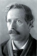
Herman-Wirth.jpgWirth présenta ainsi une vision très particulière de la relation entre le matriarcat et le patriarcat dans la culture archaïque de la région méditerranéenne. De son point de vue, les plus anciennes formes de culture en Méditerranée furent celles établies par les porteurs du matriarcat hyperboréen, qui en plusieurs étapes descendirent des régions circumpolaires, de l’Atlantique Nord, par voie de mer (et leurs navires avec des trèfles sur la poupe étaient caractéristiques). C’était le peuple mentionné dans les artefacts du Proche-Orient comme les « peuples de la mer », ou am-uru, d’où le nom ethnique des Amorrites. Le nom de Mo-uru, d’après Wirth, était jadis celui du centre principal des Hyperboréens, mais fut donné à de nouveaux centres sacrés par les natifs du Nord dans leurs vagues migratoires. C’est à ces vagues que nous devons les cultures sumérienne, akkadienne, égyptienne (dont l’écriture prédynastique était linéaire), hittite-hourrite, minoenne, mycénienne, et pélagienne. Toutes ces strates hyperboréennes étaient structurées autour de la figure de la Prêtresse Blanche.

Le patriarcat, d’après Wirth, fut apporté par des immigrants d’Asie, venant des steppes du Touran, qui déformèrent la tradition hyperboréenne primordiale et imposèrent aux cultures méditerranéennes des valeurs très différentes – primitives, violentes, agressives et utilitaires – qui s’opposèrent (c’est-à-dire qu’elles les dégradèrent) aux formes purement spirituelles du matriarcat nordique.

Ainsi chez Wirth nous avons la reconstruction suivante : le type de culture matriarcale primordial, spirituel et hautement développé du cercle culturel hyperboréen se diffusa à partir d’un centre circumpolaire, principalement par voie de mer, pénétrant en Méditerranée, effleurant l’Afrique, et atteignant même la côte sud de l’Asie jusque dans le Pacifique, où la culture maorie conserve encore des traces de l’ancienne tradition arctique. Une autre branche venant du centre de Mo-uru dans l’Atlantique Nord migra en Amérique du Nord, où elle posa les fondations du code culturel de nombreuses tribus. L’une des entreprises de Wirth fut de démontrer une homologie entre ces deux branches qui étaient issues de la culture de Thulé – la branche européenne, méditerranéenne, et aussi africaine et polynésienne d’une part, et la branche nord-américaine de l’autre [6].
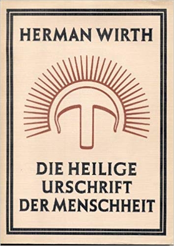
wirthurschrift.jpgEntretemps se forma en Asie continentale un pôle culturel qui représentait l’embryon du proto-patriarcat. Wirth associait cette culture au naturalisme primitif, aux cultes phalliques, et à un type de culture martial, agressif et utilitaire, que Wirth considérait comme inférieur et asiatique. Nous avons consacré un volume entier à un exposé plus détaillé des idées de Wirth [7].

La signification des idées de Wirth pour la géosophie

De nombreux aspects des travaux injustement oubliés d’Herman Wirth méritent attention dans l’étude de l’anthropologie plurielle. Avant tout, son hypothèse extrêmement fertile du cercle culturel de Thulé, qui est généralement rejetée d’emblée sans aucune analyse sérieuse de son argumentation, est si riche qu’elle mérite une sérieuse attention à elle seule. Si une telle hypothèse permet la résolution de si nombreux problèmes historiques et archéologiques associés à l’histoire des symboles, des signes, des mythes, des rituels, des hiéroglyphes, du calendrier, de l’écriture et des plus anciennes idées de la structure de l’espace et du temps, alors cela en soi est suffisant pour justifier un examen approfondi. Même si les travaux de Wirth contiennent de nombreuses affirmations qui semblent complètement fausses ou hautement douteuses, nous pouvons les laisser de coté et tenter de comprendre l’essence de sa théorie qui, à notre avis, est une version extraordinairement constructive qui élargit notre compréhension des époques archaïques de l’ancienne histoire de l’humanité. On n’est pas obligé d’accepter inconditionnellement la théorie du cercle culturel de Thulé, mais une évaluation de son potentiel interprétatif est nécessaire.

Deuxièmement, l’évaluation positive du matriarcat par Wirth est extrêmement intéressante et donne du poids aux idées de Bachofen. En effet, nous avons affaire à une interprétation d’une civilisation matriarcale conditionnellement reconstruite à partir de la position de ce qu’est le patriarcat, théorique du moins, auquel notre société s’est habituée. Wirth propose une interprétation alternative du Logos féminin, une tentative de voir le Logos de la Grande Mère avec des yeux différents. C’est aussi une proposition extrêmement non-conventionnelle et fertile.

Troisièmement, dans les théories de Wirth nous pouvons voir de claires analogies avec les reconstructions de Spengler et de Frobenius. Alors que Frobenius et particulièrement Spengler prirent le parti de la culture indo-européenne (touranienne, eurasienne), c’est-à-dire le camp du patriarcat tel qu’ils l’interprétaient, Wirth propose de regarder les choses du point de vue de la civilisation des Dames Blanches, c’est-à-dire depuis la position de la culture méditerranéenne primordiale qui précéda l’invasion des « peuples aux chars de guerre ».

Notes

[1] Tilak, B.G., Arkticheskaiia rodina v Vedakh (Moscow: FAIR-PRESS, 2001). En anglais : Tilak, B.G., The Arctic Home in the Vedas: Being Also a New Key to the Interpretation of Many Vedic Texts and Legends (Poona City: Tilak Bros, 1903).

[2] Dugin, A.G., Znaki Velikogo Norda: Giperboreiskaiia Teoriia (Moscow: Veche, 2008). Une traduction anglaise de l’introduction est disponible ici : http://www.4pt.su/en/content/herman-wirth-runes-great-yul.... Une traduction française a été publiée dans le gros recueil de textes d’Alexandre Douguine, Pour le Front de la Tradition, Ars Magna, 2017, p. 509.

[3] Wirth, H., Khronika Ura-Linda. Drevneishaiia istoriia Evropy (Moscow: Veche, 2007). En allemand : Wirth, Herman. Die Ura-Linda Chronik (Leipzig: Koehler & Amelang, 1933).

[4] Wirth, H., Der Aufgang der Menschheit. Forschungen zur Geschichte der Religion, Symbolik und Schrift der atlantisch-nordischen Rasse (Jena: Diederichs, 1928).

[5] Wirth, H., Die Heilige Urschrift der Menschheit. Symbolgeschichtliche Untersuchungen diesseits und jenseits des Nordatlantik (Leipzig: Koehler & Amelang, 1936).

[6] Le titre complet du livre de Wirth, Die Heilige Urschrift der Menschheit, spécifie « des deux cotés de l’Atlantique Nord ». Voir note 5.

[7] Voir note 2.

Chapitre 22 de la Partie 2, « Théories des Civilisations : critères, concepts, et correspondances », du livre Noomachy: Wars of the Mind – Geosophy – Horizons and Civilizations (Moscou, Akademicheskii Proekt, 2017).
samedi, 18 février 2017

The Lombards

lombardswarrr.jpg

The Lombards

At the end of the sixth century, he Roman Empire, rocked by relentless waves of violent barbarians -- Goths, Huns, Vandals -- civilization on the Italian penisula teeters on the brink of collapse. As famine, war, plague leave death devastation in their wake, out of north bursts the last of the barbarian hordes. Fiercely pagan, famous for their cruelty, the Lombards strike the final blow to the Roman Empire.
In 488 the Lombards are a small but particularly savage group of warriors on the move, surviving by viciously raiding other tribes Originating in Scandinavia and migrating south, into Roman regions, they eventually inhabit what became modern day Austria and Hungary At the turn of the 6th century only the eastern half of the empire remains, ruled by the Byzantine emperor from Constantinople.

Alboin, king of the Lombards, was celebrated as a man fitted for wars, with noble bearing and courage. The emperor Justinian recruited Alboin and the Vandals to aid in the reconquest of Italy which was controlled by the Goths. The Roman military leaders disgusted by the uncontrolled Lombard warriors, relegated them to a new homeland along the banks of the Danube River. In 568, the Lombards, well familiar with Italy from earlier days as Roman mercenaries, invade Rome, inviting Saxons, Bulgars and other barbarian tribes to join.

Much of our information regarding the Lombards is found in the 8th century chronicler Paul the Deacon's work, HISTORY OF THE LOMBARDS, translated by William Dudley Foulke, LL.D., edited with introduction by Edward Peters, University of Pennsylvania Press, Philadelphia, 1907

This History Channel documentary series, Barbarians 2, tells the fascinating stories of four of the most fabled groups of fighters in history, the Saxons, the Lombards, the Franks, the Vandals, tracing 1,000 years of conquest and adventure through inspired scholarship and some of the most extensive reenactments ever filmed.

mardi, 03 janvier 2017

Alemanni

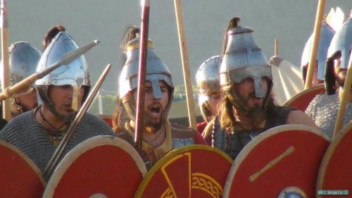
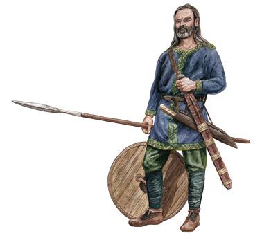
alemanniguerriers.jpg

Alemanni

Definition

Ex: http://www.ancient.eu 

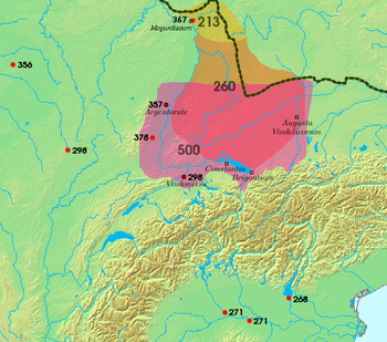
The Alemanni (also known as the Alamanni and the Alamans, meaning "All Men" or "Men United") were a confederacy of Germanic-speaking people who occupied the regions south of the Main and east of the Rhine rivers in present-day Germany. Many historians claim that the Alemanni first enter the historical record in 213 CE when Cassius Dio records the campaigns of Caracalla and his duplicitous dealings with the Alemanni. It is true that the name "Alemanni" first appears in Cassius Dio but, if one accepts that the Alemanni and the Suebi (or Suevi, who appear in earlier records) were the same (as not all do), then their first mention comes in 98 CE in Tacitus' Germania. They were a constant threat to the Roman Empire from 213 CE until they were defeated by Julian at the Battle of Strasbourg in 357 CE and then again by Valentinian I in 367 CE. After the Battle of Strasbourg, Julian entered into treaties with the Franks of Gaul who were then left alone by Rome. They were able to stabilize their communities and grow in power until, in 496 CE, the Frankish king Clovis conquered the Alemanni tribes and absorbed them into his kingdom. After this, their name lived on in the language of the region they had once inhabited and in the name given to Germany, Allemagne, in French and other languages.

THE ALEMANNI WERE STILL A FORMIDABLE FORCE WHEN THEY JOINED THE FORCES OF ATTILA THE HUN AND BATTLED THE ROMANS IN 451 CE.

APPEARANCE & RELIGION

The Roman senator and historian Tacitus (56-117 CE) wrote of the Suevi in the 1st century CE, claiming they controlled the better part of the region known as Germania. He links the Alemanni with the Hermunduri, another Germanic tribe, but this claim has been contested by modern-day scholarship. The Suevi Tacitus depicts sound very much like the later Alemanni, in that they were a confederation of different tribes, which may have even included the Cherusci (famous for their leader Arminius' destruction of Varus' three legions in Teutoburger Wald in 9 CE). Tacitus is the first writer to note the Suevi's distinctive hair styles and religious practices. He writes:

We have now to speak of the Suevi; who do not compose a single state, like the Catti or Tencteri, but occupy the greatest part of Germany and are still distributed into different names and nations, although all hearing the common appellation of Suevi. It is characteristic of this people to turn their hair sideways, and tie it beneath the poll in a knot.

By this mark the Suevi are distinguished from the rest of the Germans; and the freemen of the Suevi from the slaves. Among other nations, this mode, either on account of some relationship with the Suevi, or from the usual propensity to imitation, is sometimes adopted; but rarely, and only during the period of youth.

The Suevi, even till they are hoary, continue to have their hair growing stiffly backwards, and often it is fastened on the very crown of the head. The chiefs dress it with still greater care and in this respect they study ornament, though of an undebasing kind. For their design is not to make love, or inspire it; they decorate themselves in this manner as they proceed to war, in order to seem taller and more terrible; and dress for the eyes of their enemies (Germania, 38).

Regarding religion, Tacitus writes that the Suevi were pagan and seem to have practiced a form of Druidism. Their chiefs were drawn from a tribe in the confederation known as Semnones who also served as high priests:

The Semnones assert themselves to be the most ancient and noble of the Suevi; and their pretensions are confirmed by religion. At a stated time, all the people of the same lineage assemble by their delegates in a wood, consecrated by the auguries of their forefathers and ancient terror, and there by the public slaughter of a human victim celebrate the horrid origin of their barbarous rites. Another kind of reverence is paid to the grove. No person enters it without being bound with a chain, as an acknowledgment of his inferior nature, and the power of the deity residing there. If he accidentally falls, it is not lawful for him to be lifted or to rise up; they roll themselves out along the ground. The whole of their superstition has this import: that from this spot the nation derives its origin; that here is the residence of the Deity, the Governor of all, and that everything else is subject and subordinate to him. These opinions receive additional authority from the power of the Semnones, who inhabit a hundred cantons, and, from the great body they compose, consider themselves as the head of the Suevi (Germania, 39).

The religious practices centered on chthonic locales, then, where a central deity held sway. Rivers, streams, glades, and valleys were often chosen as sacred ground for the energies which manifested themselves in these locales. As with many other ancient civilizations, the Suevi believed the soul had to cross a body of water to reach the afterlife and that the soul lived on after death. Suevi/Alemanni grave excavations have revealed that they were buried fully dressed and with personal items that they would need in the next world. These burial practices continued after they converted to Christianity sometime between the 6th and 8th centuries CE although, of course, their religious practices changed dramatically.

THE ALEMANNI & ROME

Although the Suevi have been identified with the later Alemanni, historians caution against equating the two without recognizing their differences over the centuries which separate Tacitus' account (98 CE) from Cassius Dio's (c. 229 CE). The scholar Guy Halsall writes, "It is unlikely that the situation which pertained in the mid-first century was at all relevant to the late Roman period. Tacitus' Germania is a minefield probably best avoided [in this regard]" (121). The scholar Peter Heather comments on this also, stating how unified the Alemanni appear in the work of Ammianus Marcellinus (c. 325-391 CE) while, "One of the central points brought home by even the quickest read of Tacitus' Germania is just how fragmented, in political terms, the Germanic world was at that date" (36). It is for this reason that historians usually cite Cassius Dio's account as the first mention of the Alemanni and ignore Tacitus' earlier description of the Suevi.

By the time of Dio's account, the Alemanni were largely Romanized from their long acquaintance with the Romans. Halsall writes how, in the border region of the Danube and the Roman Empire,

some of the Alemanni, who it has been suggested were formed at least partly by the Romans themselves from inhabitants of the agri decumates [a term possibly meaning 10 agricultural regions]and authorised barbarian settlers, occupied former Roman villa sites, such as at Wurmlingen in Baden Wurttemberg (128).

The Alemanni at this time wore Roman attire and emulated Roman social customs. Even so, they were not 'Romans' in the accepted sense of that word and maintained their own language and culture. Therefore, when they asked the emperor Caracalla for help against a neighboring tribe in 213 CE, he saw no reason why he should not conquer them instead. Cassius Dio writes:

Antoninus [Caracalla] made a campaign against the Alamanni and whenever he saw a spot suitable for habitation, he would order, "There let a fort be erected. There let a city be built." And he gave these places names relating to himself, though the local designations were not changed; for some of the people were unaware of the new names and others supposed he was jesting.  Consequently he came to feel contempt for these people and would not spare even them, but accorded treatment befitting the bitterest foes to the very people whom he claimed to have come to help. For he summoned their men of military age, pretending that they were to serve as mercenaries, and then at a given signal — by raising aloft his own shield — he caused them all to be surrounded and cut down, and he sent horsemen round about and arrested all the others (78.13.4).

Whether the Alemanni were particularly hostile to Rome before this is not known, but they became one of Rome's most bitter enemies afterwards.

Alemanni_expansion.png

ENGAGEMENTS AGAINST ROME

  • 256 CE: Gregory of Tours (c. 538-594 CE) famously wrote of the Alemanni invasion of Gaul in 256 CE under their king Chrocus. Chrocus led his army across the land, destroying the cities, churches, towns, and slaughtering the inhabitants until he was defeated at Arles and executed. Surviving members of his army were then either killed or absorbed into the Roman ranks as mercenaries.
  • 259 CE: The Alemanni invaded Italy, ravaging the fertile Po Valley, until they were defeated at the Battle of Mediolanum by a Roman force led by emperor Gallienus.
  • 268 CE: The Battle of Benacus was fought in 268/269 CE between the emperor Claudius II (supported by the later Emperor Aurelian) and the Alemanni. The Alemanni, allied with the Juthungi, invaded northern Italy and were met at Benacus by the Roman forces. The Romans again decisively defeated the Alemanni, killing most of them and scattering the rest.
  • 271 CE: The Alemanni and Juthungi again invaded Italy, while the emperor Aurelian was busy repulsing Vandals on the Danube frontier. He marched his forces to meet the Alemanni threat but was ambushed and defeated at the Battle of Placentia. This defeat resulted in widespread panic throughout Rome, as the Juthungi marched toward the city which had no sizeable force to protect it. Aurelian regrouped, however, and chased the Juthungi, finally meeting them at the Battle of Fano where he defeated them completely, driving them into the Metaurus River where many of them drowned. The surviving Juthungi then sued for a peace which Aurelian rejected. He pursued them and their Alemanni allies and destroyed most of the force at the Battle of Pavia. Those Alemanni who survived were hunted down and killed trying to escape back home through the province of Raetia. Although he had stopped the invasion and destroyed the enemy, Aurelian recognized the need for better defenses for Rome and so ordered a new and stronger wall built around the city.
  • 298 CE: The emperor Constantius defeated the Alemanni twice at the Battle of Lingones and then again at the Battle of Vindonissa.
  • 356 CE: Julian, commanding his first military force (prior to becoming emperor), was surprised and defeated by the Alemanni at the Battle of Reims.
  • 357 CE: Julian defeated the Alemanni at the Battle of Strasbourg, completely overwhelming their forces and capturing one of their most important leaders, Chnodomar (also known as Chnodomarius) who had mobilized the Alemanni for battle and led them from the front. Although Julian's victory subdued the Alemanni and allowed him to march into Germania, re-build and garrison Roman forts, and force tribute from the tribes, it did not destroy the Alemanni or disperse them. Peter Heather writes:

The defeat of Chnodomarius did not mean the total destruction of the alliance at whose head he had stood, as the defeats of his first-century counterparts such as Arminius and Maroboduus had done three centuries before. Not only were many of the lesser Alamannic kings who had participated in the battle left in place by Julian's diplomacy, but, within a decade of the battle, a new pre-eminent leader, Vadomarius, was worrying the Romans. He was skillfully removed by assassination, but then a third appeared in his place: Macrinus. Ammianus records three separate attempts by one of Julian's successors, Valentinian I, to eliminate Macrinus by capture and/or assassination, but eventually, pressed by events further east, the emperor gave in. Roman and Alamann met in the middle of the Rhine for a water-borne summit, where the emperor acknowledged Macrinus' pre-eminence among the Alamanni. Unlike in the first century, even major military defeat was not enough to destroy the larger Alamannic confederation (40-41).

alemanni1.jpgThe "major military defeat" Heather refers to is not only the Battle of Strasbourg but the later Battle of Solicinium in 367 CE, in which Valentinian I defeated the Alemanni in the southwestern region of Germany. Even though he was victorious, the Alemanni were by no means broken and were still a formidable force some 80 years later when they joined the forces of Attila the Hun and took part in the Battle of the Catalaunian Plains against the Romans under Flavius Aetius in 451 CE. Even so, the Battle of Strasbourg severely limited their abilities to threaten Rome for years after. The historian Roger Collins writes,
This single battle really turned the tide as far as the Alaman penetration of Gaul was concerned. It broke the Alamannic confederacy of tribes that had largely been built up and held together by the military credibility of Chnodomar, and for the first time enabled the Romans to take the initiative…Threatened with a Roman invasion of their own territory, the Alamans sought a truce (35).

Again, however, it must be noted that the confederacy was not disbanded nor did the Alemanni seem to consider themselves a conquered people.

THE FRANKISH CONQUEST OF THE ALEMANNI

First Julian, and then Valentinian I, entered into treaties with the confederacy of the people known as the Franks ("the fierce people"). In an effort to maintain the newly restored Roman city of Cologne, Julian blockaded the territory of the Franks, depriving them of much-needed trade goods, until they agreed to his terms. Collins comments on this, writing:

It is notable that Julian made no attempt to penetrate the marshy lands north of the Meuse that the Franks had occupied, and their continuing occupation of this area was tacitly accepted by the Romans. From this small start the subsequent Frankish occupation of all of Gaul would develop. This, it might be said, was `the birth of France'. In 357/8, however, what was achieved was a treaty of federation: Frankish occupation of Roman territory was accepted in return for their helping to defend the region (35).

This arrangement was good for the Franks, who began to steadily flourish, but not as beneficial to the Alemanni. By the time the Alemanni fought alongside the Huns in 451 CE at the Catalaunian Plains, the Franks had become powerful enough to be counted as allies of the Romans under Aetius. The Franks were united under the reign of their first king, Clovis I (466-511 CE), who then expanded the boundaries of Gaul to conquer western Europe. The Alemanni continued to inhabit the region of Germania until they were defeated by Clovis I at the Battle of Tolbiac in 496 CE and were subjugated by the Franks. Afterwards, some were assimilated into Frankish culture and took up residence in Gaul, while others continued to live in their former region under Frankish rule. Their name is remembered today in the Alemannic dialect of German, and the word for 'Germany' (Allemagne, Alemania) in many modern-day languages.

ABOUT THE AUTHOR

A freelance writer and part-time Professor of Philosophy at Marist College, New York, Joshua J. Mark has lived in Greece and Germany and traveled through Egypt. He teaches ancient history, writing, literature, and philosophy.

mercredi, 28 décembre 2016

Indo-European Dispersals and the Eurasian Steppe with J.P. Mallory

IE1.png

Indo-European Dispersals and the Eurasian Steppe with J.P. Mallory

J. P. Mallory speaks on Indo-European Dispersals and the Eurasian Steppe at the Silk Road Symposium held at the Penn Museum held in March 2011.

Contacts between Europe and China that bridged the Eurasian steppelands are part of a larger story of the dispersal of the Indo-European languages that were carried to Ireland (Celtic) in the west and the western frontiers of China (Tokharian, Iranian) in the east. Reviewing some of the problems of these expansions 15 years ago, the author suggested that it was convenient to discuss the expansions in terms of several fault lines -- the Dnieper, the Ural and Central Asia. The Dnieper is critical for resolving issues concerning the different models of Indo-European origins and more recent research forces us to reconsider the nature of the Dnieper as a cultural border. Recent research has also suggested that we need to reconsider the eastern periphery of the Indo-European world and how it relates to its western neighbors.

J.P. Mallory is Professor of Prehistoric Archaeology at Queen's University, Belfast, Northern Ireland.

More at http://www.penn.museum

11:17 Publié dans archéologie | Lien permanent | Commentaires (0) | Tags : archéologie, asie centrale, indo-européens | |  del.icio.us | | Digg! Digg |  Facebook

mercredi, 15 juin 2016

The Ancient Greeks: Our Fashy Forefathers

GST5.jpg

The Ancient Greeks:
Our Fashy Forefathers

Nigel Rodgers
The Complete Illustrated Encyclopedia of Ancient Greece [2]
Lorenz Books, 2014

“Western civilization” is certainly not fashionable in mainstream academia these days. Nonetheless, the ancient Greek and Roman heritage remains quietly revered in the more thoughtful and earnest circles. Quite simply, virtually all of our social and political organization, to the extent these are thought out, ultimately go back to Greek forms, reflected in the invariably Greek words for them (“philosophy,” “economy,” “democracy” . . .). Those who still have that instinctive pride of being European or Western always go back to the Greeks, to find the means of being worthy of that pride.

Thus I came to the Illustrated Encyclopedia produced by Nigel Rodgers. Life is short, and lots of glossy pictures certainly do help one get the gist of something. Rodgers does not limit himself to pictures of ancient Greek art, though that of course forms the bulk. There are also photos of the sites today, to better imagine the scene, and many paintings from later epochs imagining Greek scenes, the better show Greece’s powerful influence throughout Western history. The Encyclopedia is divided into two parts: First a detailed chronological history of the Greek world, second a thematic history showing different facets of Greek life.

GST2.jpgThe ancient Greeks are more than strange beings so far as post-60s “liberal democracy” is concerned. Certainly, the Greeks had that egalitarian and individualist sensitivity that Westerners are so known for.
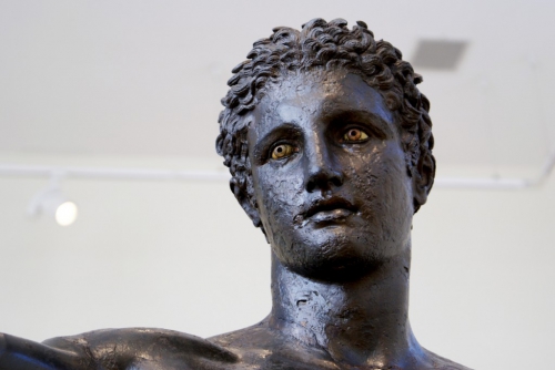
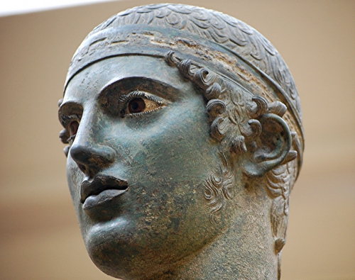
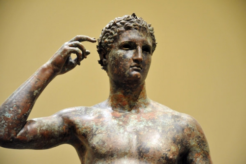
Many Greek cities imagined that their legendary founders had equally distributed land among all citizens. As inequality and wealth concentration gradually rose over time, advocates of redistribution would cite these founding myths. (Rising inequality and revolutionary equality seems to be a recurring cycle in human history.)

Famously, Athens and various other Greek cities were full-fledged direct democracies, a kind of regime which is otherwise astonishingly rare. This was of course limited to only full male citizens, about 10 percent of the population of this “slave state.” (Alain Soral, that eternal mauvaise langue, once noted that the closest modern state to democratic Athens was . . . the Confederate States of America.)

The Greeks were individualists too, but not in the sense that Americans are, let alone post-60s liberals. Their “kings” seem more like “chiefs,” with a highly variable personal authority, rather than absolute monarchs or oriental despots.

In all other respects, the Greeks were extremely “fash”: misogynistic, authoritarian, warring, enslaving, etc. One could say that, by the standards of the United Nations, the entire Greek adventure was one ceaseless crime against humanity.

The most proto-fascistic were of course the Spartans, that famous militaristic and communal state, often idealized, as most recently in the popular film 300. Sparta would be a model for many, cited notably by Jean-Jacques Rousseau and Adolf Hitler (who called the city-state “the first Volksstaat). Seven eighths of Sparta’s population was made of helots, subjects dominated by the Spartiate full-time warriors.

The Greeks generally were enthusiastic practitioners of racial citizenship. Leftists have occasionally (rightly) pointed to the fact that the establishment of democracy in Athens was linked to the abolition of debt. But one should also know that Pericles, the ultimate democratic politician, paired his generous social reforms with a tightening of citizenship criteria to having two Athenian parents by blood. (The joining of more “progressive” redistribution with more “exclusionary” citizenship makes sense: The more discriminating one is, the more generous one can be, having limited the risk of free-riding.)

In line with this, the Greeks practiced primitive eugenics so as to improve the race. The most systematic in this respect was Sparta, where newborns with physical defects were left in the wilderness to die. By this cruel “post-natal abortion” (one can certainly imagine more human methods), the Spartans thus made individual life absolutely secondary to the well-being of the community. This is certainly in stark contrast to the maudlin cult of victimhood and personal caprice currently fashionable across the West.

GST1.jpg

Athenian democracy was also known for the systematic exclusion of women, who seemed to have had lives almost as cloistered and private as that of pious Muslims. The stark limitations on sex (arranged marriages, the death penalty for adultery) may have also contributed to the similar Greek penchant for pederasty and bisexuality. Homosexuals were not a discrete social category (how sad for anyone to make their sexual practices the center of their identity!). Homosexual relationships, in parallel to wives, were often glorified as relations of the deepest friendship and entire regiments of male lovers were organized (e.g. the Sacred Band of Thebes [3]), with the idea that by such bonds they would fight to the death.

To this day, it is not clear if we have ever matched the intellectual and moral level of the Greeks (and I do not confuse morality with sentimentality, the recognition of apparently unpleasant truths is one of the greatest markers of genuine moral courage). Considering the education, culture (plays), and politics that a large swathe of the Greek public engaged in, their IQs must have been very high indeed.

Some argue we have yet to surpass Homer in literature or Plato in philosophy. (In my opinion, our average intellectual level is clearly much lower and our educated public probably peaked in consciousness and morality between the 1840s and 1920s. Our much superior science and technology is of no import in this respect, we’ve simply acquired more means of being foolish, something which could well end in the extinction of our dear human race.)

Homer’s influence over the Greeks was like “that of the Bible and Shakespeare combined or to Hollywood plus television today” (29). (Surely another marker of our catastrophic moral and intellectual decline. Of course, in a healthy culture, audiovisual media like cinema and television would be propagating the highest values, including the epic tales of our Greek heritage, among the masses.)

GST3.jpg

Homer glorified love of honor (philotimo) and excellence (areté), a kind of individualism wholly unlike what we have come to know. This was a kind of competitive individualism in the service of the community. They did not glorify individual irresponsibility or fleeing one’s community (which, to some extent, is the American form of individualism). If the hoplite citizen-soldiers did not fight with perfect cohesion and discipline, then the city was lost.

Dominique Venner has argued [4] that Homer’s Iliad and Odyssey should again be studied and revered as the foundational “sacred texts” of European civilization. (I don’t think the Angela Merkels and the Hillary Clintons would last very long in a society educated in “love of honor” and “excellence.”)

Plato, often in the running for the greatest philosopher of all time, was an anti-democrat, arguing for the rule of an enlightened elite in the Republic and becoming only more authoritarian in his final work, the Laws. Athenian democracy’s chaos, defeat in war with Sparta, and execution of his mentor Socrates for thoughtcrime no doubt contributed to this. Karl Popper argued Plato, the founder of Western philosophy, paved the way for modern totalitarianism, including German National Socialism.

The Greek city-states were tiny by our standards: Sparta with 50,000, Athens 250,000. One can see how, in a town like Sparta, one could through daily ritual and various practices (e.g. all men eating and training together) achieve an incredible degree of social unity. (Of course, modern technology could allow us to achieve similar results today, as indeed the fascists attempted and to some extent succeeded.) Direct democracy was similarly only possible in a medium-sized city at most.

The notion of citizenship is something that we must retain from the Greeks, a notion of mutual obligation between state and citizen, of collective responsibility rather than the selfish tyranny of ethnic and plutocratic mafias. Rodgers argues that polis may be better translated as “citizen-state” rather than “city-state.” The polis sometimes had a rather deterritorialized notion of citizenship, emigrants still being citizens and in a sense accountable to the home city. This could be particularly useful in our current, globalizing age, when technology has so eliminated cultural and economic borders, and our people are so scattered and intermingled with foreigners across the globe.

The ancient Greeks are also a good benchmark for success and failure: Of repeated rises and falls before ultimate extinction, of successful unity in throwing off the yoke of the Persian Empire (with famous battles at Thermopylae and Marathon . . .), and of fratricidal warfare in the Peloponnesian War.

The sheer brutality of the ancient world, as with the past more generally, is difficult for us cosseted moderns to really grasp. Conquered cities often (though not always) faced the extermination of their men and the enslavement of their women and children (often making way for the victors’ settlers). Alexander the Great, world-conqueror and founder of a still-born Greco-Persian empire, was ruthless, with frequent preemptive murders, hostage-taking, the razing of entire cities, the crucifixion of thousands, etc. He seems the closest the Greeks have to a universalist. (Did Diogenes’ “cosmopolitanism” extend to non-Greeks?) The Greeks thought foreigners (“barbarians”) inferior, and Aristotle argued for their enslavement.

GST4.jpg

The Greeks’ downfall is of course relevant. The epic Spartans gradually declined into nothing due to infertility and, apparently, wealth inequality and female emancipation. Alexander left only a cultural mark in Asia upon natives who wholly failed to sustain the Hellenic heritage. One Indian work of astronomy noted: “Although the Yavanas [Greeks] are barbarians, the science of astronomy originated with them, for which they should be revered like gods.”

One rare trace of the Greeks in Asia is the wondrous Greco-Buddhist statues [5] created in their wake, of serene and haunting otherworldly beauty.

The Jews make a late appearance upon the scene, when the Seleucid Hellenic king Antiochus IV made a fateful faux pas in his subject state of Judea:

Not realizing that Jews were somehow different form his other Semitic subjects, Antiochus despoiled the Temple, installed a Syrian garrison and erected a temple to Olympian Zeus on the site. This was probably just part of his general Hellenizing programme. But the furious revolt that broke out, led by Judas Maccabeus the High Priest, finally drove the Seleucids from Judea for good. (241)

No comment.

There is wisdom: “Nothing in excess,” “Know thyself.”

So all that Alt Right propaganda using uplifting imagery from Greco-Roman statues and history, and films like Gladiator and 300, and so on, is both effective and completely justified.

Article printed from Counter-Currents Publishing: http://www.counter-currents.com

URL to article: http://www.counter-currents.com/2016/06/the-ancient-greeks-our-fashy-forefathers/

URLs in this post:

[1] Image: http://www.counter-currents.com/wp-content/uploads/2016/06/WarriorStele.jpg

[2] The Complete Illustrated Encyclopedia of Ancient Greece: http://amzn.to/1tfxVr3

[3] Sacred Band of Thebes: https://en.wikipedia.org/wiki/Sacred_Band_of_Thebes

[4] Dominique Venner has argued: http://www.theoccidentalobserver.net/2016/04/the-testament-of-a-european-patriot-a-review-of-dominique-venners-breviary-of-the-unvanquished-part-1/

[5] Greco-Buddhist statues: https://www.google.be/search?q=greco-buddhist+art&client=opera&hs=eHN&source=lnms&tbm=isch&sa=X&ved=0ahUKEwiyte7tipvNAhWKmBoKHfcVCaAQ_AUICCgB&biw=1177&bih=639

[6] Image: http://www.counter-currents.com/wp-content/uploads/2016/06/IdentityEuropa.jpg

dimanche, 08 mai 2016

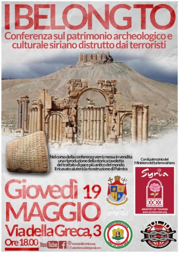
Conferenza sul patrimonio archeologico e culturale siriano distrutto dai terroristi

patrimonio51rnng97o1_500.jpg

samedi, 07 mai 2016

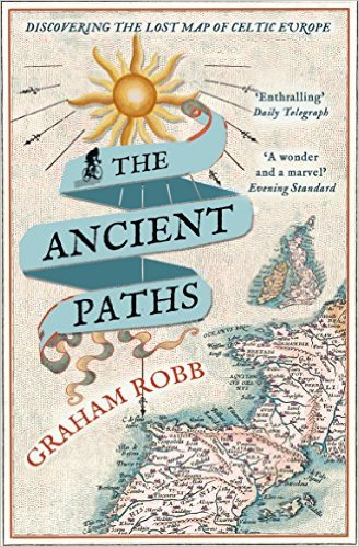
The Ancient Paths: Discovering the Lost Map of Celtic Europe

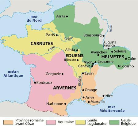
gauleeur02Carte2.jpg

The Ancient Paths: Discovering the Lost Map of Celtic Europe, review

Tim Martin has his eyes opened by an enthralling new history that argues that Druids created a sophisticated ancient society to rival the Romans

paths._SX326_BO1,204,203,200_.jpg'Important if true” was the phrase that the 19th-century writer and historian Alexander Kinglake wanted to see engraved above church doors. It rings loud in the ears as one reads the latest book by Graham Robb, a biographer and historian of distinction whose new work, if everything in it proves to be correct, will blow apart two millennia of thinking about Iron Age Britain and Europe and put several scientific discoveries back by centuries.
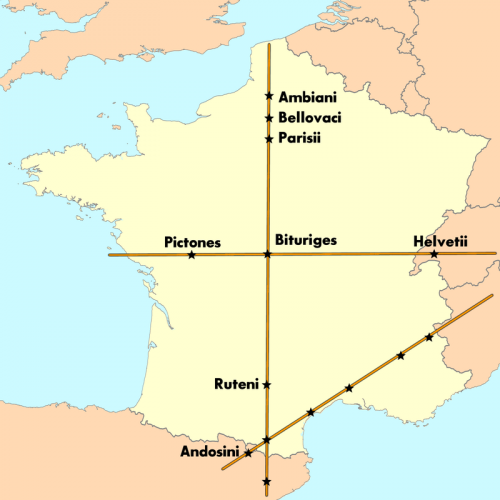
Rigorously field-tested by its sceptical author, who observes drily that “anyone who writes about Druids and mysteriously coordinated landscapes, or who claims to have located the intersections of the solar paths of Middle Earth in a particular field, street, railway station or cement quarry, must expect to be treated with superstition”, it presents extraordinary conclusions in a deeply persuasive and uncompromising manner. What surfaces from these elegant pages – if true – is nothing less than a wonder of the ancient world: the first solid evidence of Druidic science and its accomplishments and the earliest accurate map of a continent.

Robb begins his journey from a cottage in Oxfordshire, following up a handful of mysteries that had teasingly accrued as he assembled his Ondaatje Prize-winning travelogue The Discovery of France.

They had to do with the Heraklean Way, an ancient route that runs 1,000 miles in a straight line from the tip of the Iberian Peninsula to the Alps, and with several Celtic settlements called Mediolanum arranged at intervals along the route.

gaule17180_orig.png

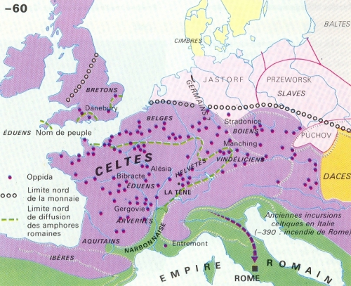
After examining satellite imaging (difficult for the private scholar even a decade ago) and making several more research trips, Robb bumped up against two extraordinary discoveries. First, the entire Via Heraklea runs as straight as an arrow along the angle of the rising and setting sun at the solstices. Second, plotting lines through the Celtic Mediolanum settlements results in lines that map on to sections of Roman road, which themselves point not to Roman towns but at Celtic oppida farther along.

Viewed in this light, the ancient texts of the Italian conquerors begin to reveal sidelong secrets about the people they supplanted. Piece by piece, there emerges a map of the ancient world constructed along precise celestial lines: a huge network of meridians and solar axes that served as the blueprint for the Celtic colonisation of Europe, dictated the placement of its settlements and places of worship, and was then almost wholly wiped from history. We are, to put it mildly, unused to thinking like this about the Celts, whose language is defunct and whose reputation was comprehensively rewritten by those who succeeded them.

Greek travellers from the sixth century BC onwards described a nation of sanguinary brutes and madmen who threw their babies in rivers, walked with their swords into the sea and roughly sodomised their guests. “It does not take an anthropologist to suspect,” Robb observes drily, “that what the travellers saw or heard about were baptismal rites, the ceremonial dedication of weapons to gods of the lower world, and the friendly custom of sharing one’s bed with a stranger.”

Later on, clean-shaven, toga-sporting Roman visitors to what they called Gallia Bracata and Gallia Comata – Trousered Gaul and Hairy Gaul respectively – were horrified by the inhabitants’ practical legwear and love of elaborate moustaches, and marvelled to hear them discoursing not in gnarly Gaulish but in perfect Greek.

As the Roman military machine rolled over Europe, depicting the Celt as a woods-dwelling wild man became not just a matter of Italian snobbery but one of propagandist utility. According to Robb, when the Romans arrived this side of the Alps, they found a country whose technical achievements were different from, but competitive with, their own.

gaulepr845241.JPG

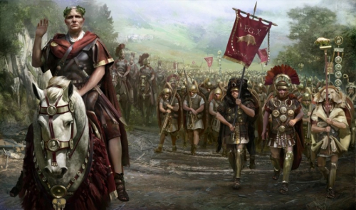
Mapped and governed by a network of scholar-priests according to a template laid down in heaven, covered by a road network that afforded swift passage to fleets of uniquely advanced chariots (“nearly all the Latin words for wheeled vehicles”, Robb notes, “come from Gaulish”) and possessing astronomical and scientific knowledge that would take another millennium to surface again, Gaul remained a deeply enigmatic place to its military-minded conquerors. When Julius Caesar swept through, on a tide of warfare and genocide that would lead his countryman Pliny to accuse him of humani generis iniuria, “crimes against humanity”, much of its knowledge retreated to the greenwood, never to emerge.

caesar.jpg

Most significantly, suggests Robb, Caesar failed to work out the Druids. To most of us even now, the word conjures up the image of a white-robed seer with a sickle, an implausible hybrid of Getafix and Glastonbury hippie. (Robb suggests, following the design on a Gaulish cauldron, that they tended more towards a figure-hugging costume patterned like oak bark: much better for melting like smoke into the trees, a trait of Druid-led armies that Caesar vigorously deplored.) The Druidic curriculum took two decades to train up its initiates, but these men of science put nothing in writing. Like their wood-built houses, their secrets rotted with time. How could we hope to reconstruct them?

Remarkably, Robb has an answer to this, and it forms the centre of a book almost indecently stuffed with discoveries. One of the most consistently baffling things about Celtic temple sites to modern surveyors is their shape: warped rectangles that seem none the less to demonstrate a kind of systematic irregularity. Using painstakingly reconstructed elements of the Druidic education, which placed religious emphasis on mapping the patterns of the heavens on to the lower “Middle Earth” of our world, Robb comes up with an astonishing discovery: these irregular rectangles exactly match a method for constructing a geometrical ellipse, the image of the sun’s course in the heavens. Such a method was previously thought to be unknown in the West until the 1500s.

Other suggestions follow thick and fast, backed by a mixture of close reading, mathematical construction and scholarly detective work. Building on meridians and equinoctial lines, the Druids used their maps of the heavens to create a map that criss-crossed a continent, providing a plan of sufficient latitudinal and longitudinal accuracy to guide the Celtic diaspora as it pushed eastward across Europe.

The swirls and patterns in Celtic art turn out, Robb surmises, to be arranged along rigorous mathematical principles, and may even encode the navigational and cartographic secrets that the Druids so laboriously developed.

Robb manages his revelations with a showman’s skill, modestly conscious that his book is unfurling a map of Iron Age Europe and Britain that has been inaccessible for millennia. Every page produces new solutions to old mysteries, some of them so audacious that the reader may laugh aloud. Proposing a new location for Uxellodunum, the site of the Gauls’ final losing battle in France, is one thing; suggesting where to look for King Arthur’s court, or which lake to drag for Excalibur, is quite another. But both are here.

Amid such riches, readers of The Discovery of France – a glorious book that mixed notes from a modern cycling tour with a historical gazetteer of pre-unification France – may still be itching for the moment when the author gets back on his bike. Beautifully written though it is, The Ancient Paths can tend to dryness at times, but some of its best moments come when the author gets out into the field.

One example will suffice. Certain references in Caesar’s writing indicate that the Gauls operated a vocal telegraph, composed of strategically placed teams yodelling news overland to one another, which passed messages at a speed nearly equivalent to the first Chappe telegraph in the 18th century. To judge how this might have worked, Robb takes himself off to the oppidum above Aumance, near Clermont-Ferrand, where he reports on the car alarms and the whirr of traffic still audible across countryside four kilometres away.

He goes further. Aumance was one of around 75 places once known by the name Equoranda, a word with an unknown root that resembles the Greek and Gaulish for “sound-line” or “call-line”. All the Equoranda settlements Robb visits turn out to be on low ridges or shallow valleys, and would, he writes, “have made excellent listening posts”. Examined in this light, one word in Caesar’s account becomes fruitful: he observes that the Gauls “transmit the news by shouting across fields and regios”, a word that can be translated as “boundaries”. An ancient Persian technique for acoustic surveying, still current in the 19th-century south of France, involves three men calling to one another and plotting their position along the direction of the sound. Put the pieces together and you end up – or Robb does – with “the scattered remains of a magnificent network” that could have acted not just as a telegraph system but as a means to map the Druids’ boundaries on to the earth.

It’s a magnificent piece of historical conjecture, backed by a quizzical scholarly intellect and given a personal twist by experiment. So, for that matter, is

the whole thing. Robb describes in his introduction the secretive meetings with publishers in London and New York that kept a lid on the book’s research until publication, and watching its conclusions percolate through popular and academic history promises to be thrilling.

Reading it is already an electrifying and uncanny experience: there is something gloriously unmodern about seeing a whole new perspective on history so comprehensively birthed in a single book. If true, very important indeed.

The Ancient Paths: Discovering the Lost Map of Celtic Europe, by Graham Robb (Picador, RRP £20, Ebook £6.02), is available to order from Telegraph Books at £26 + £1.35p&p. Call 0844 871 1515 or visit books.telegraph.co.uk


mardi, 03 mai 2016

Chachapoya

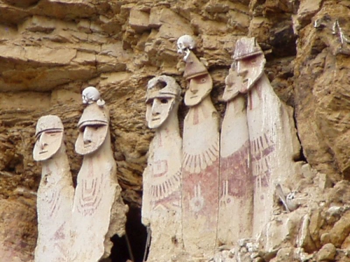
chacha.jpg

Chachapoya

By

Ex: https://www.lewrockwell.com

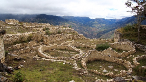
On the eastern slopes of the Andes Mountains, in the remote San Martin Province of Peru, lie the abandoned ruins of a mysterious civilization. Modern Peruvians tell us that a people whom they call the Chachapoya, “the cloud people,” built these structures. The most notable of these is the massive Kuelap Fortress, which contains more stone than even the pyramid of Cheops in Egypt. The Chachapoyan civilization, which according to the carbon-14 dating method dates at least as far back as 400 AD, existed until around 1500 AD. At that time, it succumbed to two external forces that arose in short succession. First, the expanding Incan Empire, which conquered the Chachapoyan civilization around 1490 after 20 years of fierce resistance, and next, diseases that the Europeans introduced after 1492 and which started showing up among the Chachapoya around 1535, diseases to which the Chachapoya had no immunity.

The principal mystery of the Chachapoyan civilization lies in is its origin. The Chachapoyan ruins give evidence of an advanced civilization that must have required centuries to develop. Yet none of this development appears to have taken place in South America. Culturally the Chachapoyan civilization seems to have borrowed nothing from other South American civilizations and geographically the Chachapoya were not even near any of them. The Chachapoyan civilization, therefore, most likely arose in ancient times somewhere outside of South America, and then, still in ancient times, dropped down out of nowhere in Peru.

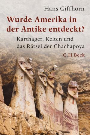
giff.jpgProfessor Hans Giffhorn of Germany has made studying the Chachapoyan civilization his life’s work and has advanced an interesting theory regarding its origin.  After many years of research starting in the 1990’s, Professor Giffhorn published a fascinating German language book in 2013 entitled Wurde Amerika in der Antike entdeckt? (“Was America discovered in antiquity?”)
Professor Giffhorn draws on scientific evidence to demonstrate that the Chachapoya probably came from the Old World. Medical examinations of Chachapoyan mummies starting around ten years ago at Quinnipiac College near New Haven, Connecticut have proved that some of the Chachapoya suffered from the disease of tuberculosis. Now tuberculosis is a disease that human beings ordinarily contract from cattle. Inasmuch as there were no cattle in the New World prior to 1492, it is logical to suspect that the ancestors of the Chachapoya contracted tuberculosis somewhere in the Old World where cattle were present and then brought the tuberculosis with them to South America.

Professor Giffhorn draws on cultural evidence to pinpoint Europe in general and the Mediterranean Sea in particular as the specific region in the Old World where the Chachapoyan civilization most likely arose.  Giffhorn drew this conclusion after noting many similarities between the Chachapoyan civilization and two civilizations of ancient Europe, the Carthaginian civilization of the Balearic Islands in the western Mediterranean Sea and the Keltic civilization of northern Spain. Among these are similarities in burial customs, religion, art, pottery, and the weaving of textiles. There are several pieces of evidence, however, that deserve special mention.

First, both the ancient Kelts and the Chachapoya kept the skulls of enemies that they had defeated in battle and then publicly displayed these skulls in and around their homes and other buildings. Moreover, both the Kelts and the Chachapoya customarily drilled holes in these skulls using an unusual technique requiring the use of conical drills.

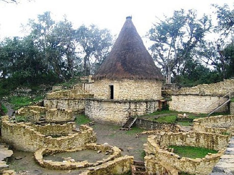
Secondly, both the Chachapoya of Peru and the Kelts of ancient Spain customarily built round buildings out of stone rather than rectangular or square buildings out of wood, as was the custom throughout most of pre-Columbian South America. Separate teams of archeologists have reconstructed both sets of round stone buildings, and, as is obvious even from their photographs in Professor Giffhorn’s book, they are almost identical, in spite of the fact that the European and South American teams of archeologists were unaware of each other until after they had completed their reconstructions.

Thirdly, the Chachapoya used slingshots as military weapons. Moreover, the slingshots used by the Chachapoya resembled in many details those used by the ancient Carthaginian warriors in the Balearic Islands. Slingshots of were common weapons throughout the ancient Mediterranean. For example, recall the Old Testament story of David and Goliath.

chachapoyas1xxxxx.jpg

Professor Giffhorn tries to make sense of all of this by starting with proven facts about antiquity and then connecting them with some educated guesses. In this way he has provided a speculative but by no means impossible scenario that traces the migration of certain ancient peoples all the way from Europe to Peru.

It is known that the ancient Carthaginians were bold explorers who, starting roughly around 700 BC, mounted a series of maritime expeditions that started from the Mediterranean Sea, passed through the Straits of Gibraltar into the Atlantic Ocean, and then sailed a long way down the coast of Africa. Their Mediterranean neighbors, including even the Romans, had little interest in exploring the Atlantic Ocean, partly out of superstitious fears of monsters and other dangers that lurked beyond Gibraltar. This gave the Carthaginians free reign to continue their explorations without interference from rivals. Moreover, there is evidence that the ancient Carthaginians not only traveled a great distance to the south but also a great distance to the west. In 1749, Carthaginian coins were discovered on the island of Corvu in the Azores Islands. The location of Corvu at the far western end of the Azores suggests that whoever left these coins had probably been traveling from west to east when they stopped at Corvu.

Two ancient writers provide some tantalizing details regarding the Carthaginians’ explorations: Diodor of Sicily, who lived about a century before Christ, and Pseudo-Aristotle, a mysterious man whose writings were included in the works of Aristotle but who was probably someone other than the famous Greek philosopher. These ancient writers tell a similar story, some of it based on the still earlier writings of Timaios of Tauromenium, Sicily (c. 345‑250 BC). According to these ancient writers, around 400 BC Carthaginian explorers sailing along the coast of Africa lost control of their ships during a fierce storm and eventually landed far to the west on what they called the “Great Island.” Now the Carthaginians’ main interest had always been in trade, but they saw no possibility for developing a trading relationship with a land that they assumed to be uninhabited. So after the Carthaginians recovered from their misfortunes, they made their way back to their homeland without leaving any colonists behind.  At the same time, they did at least take note of the precise location of the Great Island and carefully kept it to themselves. In the event that their Mediterranean homeland were ever overrun, the Carthaginians had a safe haven whose location only they knew and where they could start afresh without interference from any of their former neighbors.

But this still leaves open the question of just where the Carthaginians had landed.  Historians have usually assumed that the Great Island was most likely Madeira, but could also have been either one of the Cape Verde Islands or one of the Canary Islands. Professor Giffhorn, however, points out that if these historians had taken the trouble to visit these islands, they might have had second thoughts before so quickly identifying any of them as the Great Island. According to the Carthaginian descriptions that have come down to us second­-hand from the ancient writers, the Great Island was a bountiful land filled with navigable rivers, fruits, wild animals, wide plains, and many species of trees. By contrast, the above‑mentioned Atlantic islands were desolate islands with no navigable rivers, few plains, and not much to offer in the way of wild game, fruits, or vegetables. Most of what they do have today was imported by modern Europeans and could not have been visible to ancient explorers.

chachapoyas1.jpg

Might the Great Island have been a Caribbean island, perhaps one of those that Columbus discovered in 1492? It is not likely. According to the ancient writers, the Carthaginians reached the Great Island in far less time than would have been required to reach any of the Caribbean islands.

The only land that really fits the description of the Great Island is, surprisingly, the stretch of South American coast between what are now the Brazilian cities of Fortaleza and Recife. Now the reader might reasonably object that if the Great Island had really been northeastern Brazil, then that would imply that the Carthaginian sailors had been blown from the west coast of Africa all the way across the Atlantic Ocean to the east coast of South America. Could such a thing have been possible? As implausible as it may seem to us, this is precisely what did happen in 1500 AD to Portuguese explorer Pedro Cabral, the modern discoverer of Brazil. We should bear in mind that the eastern tip of Brazil is only about 1800 miles away from the Western Bulge of Africa, roughly the distance between New York City and Denver. Even today, objects like worn-out refrigerators tossed into the Atlantic Ocean by West Africans have been known to wash up on Brazilian beaches.

For a long time, the Carthaginian civilization thrived to the extent that the Carthaginians had no need to worry about the future of their homeland. Eventually, however, they found themselves up against a powerful new enemy in the Romans. In 146 BC, the Romans captured and destroyed the city of Carthage on the north coast of Africa in what is now the nation of Tunisia. Although the Romans had conquered Carthage, the Carthaginian colonies in the Balearic Islands continued for the time being to remain free of Roman control. But their inhabitants were undoubtedly aware of the downfall of their mother-city of Carthage and may have concluded that it was only a matter of time until they suffered the same fate. Rather than stand by and wait until their turn came, the more enterprising persons among them made plans to move permanently to the half-forgotten Great Island. Before setting sail, however, the Carthaginians brought in their old friends and allies from northern Spain, the Kelts, as junior partners. It was a far-sighted move. The Kelts had considerable experience in agriculture, something that might prove handy on the Great Island and something that the Carthaginians themselves sorely lacked. For their part, the Kelts might not have needed much persuasion to join the Carthaginians on their journey to the Great Island. The Kelts despised the Romans as much as the Carthaginians did and might have shared their fears as to what would happen to them if they too fell under Roman control.

After crossing the Atlantic Ocean, the Kelts and the Carthaginians probably landed near what is now the city of Recife. Instead of being content to settle right where they landed, however, the Europeans began looking for an opening into the interior of South America. The newly arrived Europeans might have been motivated by fears that Roman pursuers were hot on their heels and ready to drag them back to a life of slavery in the Roman Empire. Such fears might not have been entirely unfounded. The ancient writers tell us that shortly after the destruction of Carthage, the Romans sent a naval expedition, led by one of the military commanders involved in the destruction of that city, down the coast of Africa to approximately the latitude of the Cape Verde Islands. After not finding what they were looking for, the Romans turned around and sailed back to the Mediterranean empty‑handed. Just what the Romans had been looking for was not recorded, but perhaps it was runaway Kelts and Carthaginians.

In their search for a suitable opening into the interior, the Kelts and the Carthaginians proceeded north along the Brazilian coast and eventually bumped into the mouth of the mighty Amazon River. They might have been initially tempted to settle there permanently. Agriculture was possible there, and at least the Kelts had experience in agriculture. But the Kelts’ experience had been in Europe, so they might not have had the skills to succeed in the lower Amazon, where different conditions might have required a different set of skills. Moreover, remaining in the lower Amazon would have meant facing hostile and numerically superior Indian tribes. So the Kelts and the Carthaginians started up the Amazon River and just kept going and going. Eventually after years of working their way up the river, they found the homeland they had been looking for in Peru. In addition to providing them with a somewhat familiar climate and an opportunity to practice a form of agriculture that they did understand, the new land offered them security. Distance protected them from the brutal Indian tribes to the east and the towering Andes Mountains protected them from any potential enemies to the west. So here the Kelts and the Carthaginians settled down after their heroic odyssey and started a new life that lasted until around 1500 AD.

Hans-Giffhorn.jpg

Although the Carthaginians probably conceived the plan to migrate to the Great Island, in the end, it was the Kelts who put the greater stamp on the civilization that emerged in Peru. Professor Giffhorn has provided a medical explanation for this disparity. When the Carthaginians teamed up with the Kelts in their joint move to the Great Island, they did not realize that the Kelts, who had mainly been farmers, had a long history of contact with cattle and exposure to tuberculosis. Now by this time the Kelts themselves had developed immunity to tuberculosis, but the Carthaginians, who had not been farmers, had had no such contact and had developed no such immunity. So the intermingling of the Kelts and the Carthaginians might have hit the Carthaginians very hard, with many of them succumbing to tuberculosis that they contracted from the Kelts even as the Kelts themselves remained healthy.

The Chachapoyan civilization is long gone and the conventional view has it that the Chachapoyan people died out without leaving any descendants. In three remote Peruvian villages, however, there live people who look remarkably like Europeans. Having fair complexions, freckles, often red or blond hair (combined, oddly enough, with brown rather than blue eyes), the Gringuitos, as they are called by the Peruvians, resemble Irishmen more than they resemble South Americans. According to local lore, the Gringuitos had already been in Peru centuries before Columbus and are not descended from any of the Europeans who arrived after 1492. We can find a possible explanation for the origin of the Gringuitos in the writings of Spanish soldier and poet Garcilaso de la Vega (1501-1536). According to the latter, around the time that the Chachapoyan civilization was beginning to crumble, some of the Chachapoya saw the handwriting on the wall and fled into remote regions for their own safety. Such a flight might have protected them from both Incan warriors and from European diseases and enabled them to continue their lives and culture in another location, even down to the present day.

Modern DNA technology might throw some light on this subject. Archeologists would like to use DNA analysis on the above-mentioned Chachapoyan mummies, but the Peruvian Government up to now has not permitted such testing, perhaps out of fear that the results might offend Peruvian pride by showing that the Chachapoyan civilization was only European in origin. Professor Giffhorn and his team, however, were at least able to conduct DNA testing of saliva samples provided by a small number of the Gringuitos. The results of this random testing show a strong resemblance to the pattern of DNA found in northern and northwestern Spain, precisely the regions controlled long ago by Kelts. It would appear possible, therefore, that the Gringuitos are descended from the Chachapoya, who in turn were descended from the Kelts and the Carthaginians. If that is indeed the case, then the Gringuitos would have to be reckoned among history’s greatest survivors. Twice in their history, they escaped extinction in the nick of time. The first time, around 150 BC, they fled their Mediterranean homeland to escape from the Romans. Then after about 1500 BC, they fled their Chachapoyan homeland to escape from the Incas and the Europeans.

00:05 Publié dans archéologie | Lien permanent | Commentaires (0) | Tags : chachapoyas, archéologie, pérou, amérique du sud, andes | |  del.icio.us | | Digg! Digg |  Facebook

vendredi, 22 avril 2016

Un probable deuxième site viking découvert en Amérique

drakkar.jpg

Un probable deuxième site viking découvert en Amérique

Ex: http://metamag.fr

Des vestiges ont été retrouvés bien plus au sud que le premier emplacement mis au jour

Les drakkars se sont-ils aventurés davantage vers le sud des côtes américaines? La découverte au Canada de ce qui pourrait constituer le deuxième site viking en Amérique relance les spéculations sur leur parcours dans le Nouveau Monde, 500 ans avant Christophe Colomb.

Une équipe d’archéologues dirigée par l’Américaine Sarah Parcak a mis au jour au sud-ouest de l’île canadienne de Terre-Neuve des vestiges qui pourraient bien avoir été un bâtiment érigé par les navigateurs scandinaves, ont-ils annoncé vendredi.

Jusqu’à présent, la présence Viking en Amérique n’avait été confirmée qu’à l’extrême nord de Terre-Neuve, à l’Anse aux Meadows. Les fondations de huit bâtiments, ainsi que des artefacts, avaient été découverts dans les années 1960 à l’emplacement de ce qui, selon les archéologues, avait constitué un village habité par ces Européens entre 900 et 1050.

Viking_settlement_was_foun.jpg

Traces de charbon de bois

A l’aide de relevés satellites, Sarah Parcak a identifié le site de Pointe Rosée, à 500 kilomètres au sud de l’Anse aux Meadows. Elle y a mené deux semaines de fouilles en juin dernier. Outre un foyer destiné à une forge, les fouilles ont permis de découvrir de traces de charbon de bois et neuf kilogrammes de scories, c’est-à-dire des résidus de fer transformé à partir de tourbe, un procédé bien connu des Vikings qui n’étaient pas de grands mineurs. En utilisant la datation au carbone 14, l’équipe de Sarah Parcak a conclu que le lieu découvert a été fréquenté entre 800 et 1300, soit lorsque les navigateurs scandinaves sillonnaient l’Atlantique Nord.

« Vinland »

«C’est très excitant. Cette découverte donne espoir de trouver un site occupé plus longtemps et de manière plus significative», a indiqué Karyn Bellamy-Dagneau, une historienne canadienne spécialiste du Moyen-Age scandinave. Dans les «Sagas», ces textes semi-légendaires narrant les épopées des Vikings, les Scandinaves évoquent une terre luxuriante baptisée «Vinland», sise au-delà du Groenland qu’ils avaient déjà colonisée.

Pointe Rosée relance donc les spéculations des chercheurs: jusqu’où les Vikings ont-ils navigué? La péninsule de Pointe Rosée se situe à la pointe méridionale de Terre-Neuve, là où les eaux du golfe du Saint-Laurent rencontrent celles de l’Atlantique Nord. Elle constitue donc un bon avant-poste pour explorer le Saint-Laurent ou le littoral américain, relève Karyn Bellamy-Dagneau.
Les côtes du Maine ne sont par exemple qu’à quelques heures de traversée. Et c’est dans cet état américain qu’une pièce en cuivre datant du XIe siècle a été retrouvée, il y a quelques années.

L’emplacement de Pointe Rosée correspond aux usages des Vikings car «ils avaient besoin d’un endroit accessible facilement depuis la plage et offrant un bon point de vue. Ce lieu est donc situé parfaitement: vous pouvez voir vers le nord, l’ouest et le sud», a déclaré Sarah Parcak au magazine National Geographic qui a financé une partie de ses recherches.

«Nous n’en sommes qu’au début des recherches. Jusqu’à présent, aucune preuve ne démontre que ce sont des Vikings qui ont fréquenté ce lieu», confie à l’AFP Shannon Lewis-Simpson, archéologue à l’Université Memorial de Terre-Neuve. Elle rappelle qu’il a fallu huit années de fouilles pour tirer les conclusions sur l’Anse aux Meadows.

«Enthousiaste» au sujet des travaux de Sarah Parcak, elle souligne que dans cette île canadienne, «personne n’a jamais enterré l’idée qu’un autre site viking pourrait être découvert».

samedi, 26 mars 2016

Bronze Age roots of European Paganism

bronze8318131658cb57d7c6c8943f.jpg

Bronze Age roots of European Paganism

A deep and insoluble question that dogs the history of paganism in northern Europe before the advent of Greek and Roman expansion and christianity is that which asks about its structure and theology. Was it generally polytheist – believing in a host of different gods each with individual functions? If so, did it follow a similar system to the southern European religions? …. Or was its focus dualist – having god and goddess figures representing the perceived universal polarities? What if the dualist interpretation is the root of the polytheist, even?

Romans such as Julius Caesar (1stC BC De Bello Gallico) wrote that the ‘barbarian’ Gauls worshipped similar gods to them, but scholars consider such accounts as undetailed and lacking useful context. The fact that some Gauls in the south appear to have become quite Hellenized by the time of Caesar’s wars demonstrates the complicating factors at play. From the accounts we can see there are some apparent differences in theology and organisation between Gaulish/British and Roman official religion: Foremost was the system or college of learned druids at the apex of these societies, and also the reported emphasis on reincarnation, and the ideas about human ‘sacrifice’ that these appeared to engender:

They are said there to learn by heart a great number of verses; accordingly some remain in the course of training twenty years. Nor do they regard it lawful to commit these to writing, though in almost all other matters, in their public and private transactions, they use Greek characters. That practice they seem to me to have adopted for two reasons; because they neither desire their doctrines to be divulged among the mass of the people, nor those who learn, to devote themselves the less to the efforts of memory, relying on writing; since it generally occurs to most men, that, in their dependence on writing, they relax their diligence in learning thoroughly, and their employment of the memory. They wish to inculcate this as one of their leading tenets, that souls do not become extinct, but pass after death from one body to another, and they think that men by this tenet are in a great degree excited to valor, the fear of death being disregarded. They likewise discuss and impart to the youth many things respecting the stars and their motion, respecting the extent of the world and of our earth, respecting the nature of things, respecting the power and the majesty of the immortal gods. 

In the same book (De Bello Gallico Book 6 ch.21) Caesar claimed that the German peoples of the 1stC BC:

” … rank in the number of the gods those alone whom they behold, and by whose instrumentality they are obviously benefited, namely, the sun, fire, and the moon; they have not heard of the other deities even by report…”

bronze4.jpgCoupled to his assertion that the Germans had no Druids, Caesar was possibly making a declaration of their apparent primitivism and lack of philosophical gods and ideals. Surely no Roman would stoop to this? Caesar had his eyes on conquest…
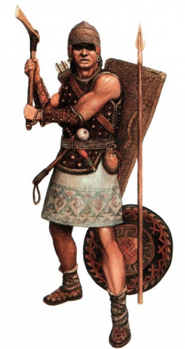
However Caesar’s life was curtailed by jealous forces, and when his successor Augustus commissioned Vergil to write the Aeneid about Rome’s supposed cultural origins at Troy, Caesar’s comment on reincarnation (seemingly a barbaric tenet) has its waters somewhat muddied by Book 6 which depicts Aeneas’ visit to Hades to his father, Anchises. During this he is instructed how purified souls drink the waters of forgetfulness from the River Lethe before crossing into reincarnation. This crossing is sometimes associated with entering Elysium – a place Homer placed on the banks of the world-encircling river, Okeanos, and which Hesiod referred to as the Blessed Isles, watched over by the Titan god Cronus (Saturn to the Romans). This is not actually that unusual as Pythagoras had a well-documented belief in metempsychosis that – along with the writings of Plato (Timaeus) and with the Greek mystery cults – had a popular following among the intellectual elites of the Roman Empire, Vergil and Ovid being particular examples. Here is that part of the Aenied:

[723] Meanwhile, in a retired vale, Aeneas sees a sequestered grove and rustling forest thickets, and the river Lethe drifting past those peaceful homes. About it hovered peoples and tribes unnumbered; even as when, in the meadows, in cloudless summertime, bees light on many-hued blossoms and stream round lustrous lilies and all the fields murmur with the humming. Aeneas is startled by the sudden sight and, knowing not, asks the cause – what is that river yonder, and who are the men thronging the banks in such a host? Then said father Anchises: “Spirits they are, to whom second bodies are owed by Fate, and at the water of Lethe’s stream they drink the soothing draught and long forgetfulness. These in truth I have long yearned to tell and show you to your face, yea, to count this, my children’s seed, that so you may rejoice with me the more at finding Italy.” “But, father, must we think that any souls pass aloft from here to the world above and return a second time to bodily fetters? What mad longing for life possesses their sorry hearts?” “I will surely tell you, my son, and keep you not in doubt,” Anchises replies and reveals each truth in order.

[724] “First, know that heaven and earth and the watery plains the moon’s bright sphere and Titan’s star, a spirit within sustains; in all the limbs mind moves the mass and mingles with the mighty frame. Thence springs the races of man and beast, the life of winged creatures, and the monsters that ocean bears beneath his marble surface. Fiery is the vigour and divine the source of those seeds of life, so far as harmful bodies clog them not, or earthly limbs and frames born but to die. Hence their fears and desires, their griefs and joys; nor do they discern the heavenly light, penned as they are in the gloom of their dark dungeon. Still more! When life’s last ray has fled, the wretches are not entirely freed from all evil and all the plagues of the body; and it needs must be that many a taint, long ingrained, should in wondrous wise become deeply rooted in their being. Therefore are they schooled with punishments, and pay penance for bygone sins. Some are hung stretched out to the empty winds; from others the stain of guilt is washed away under swirling floods or burned out by fire till length of days, when time’s cycle is complete, has removed the inbred taint and leaves unsoiled the ethereal sense and pure flame of spirit: each of us undergoes his own purgatory. Then we are sent to spacious Elysium, a few of us to possess the blissful fields. All these that you see, when they have rolled time’s wheel through a thousand years, the god summons in vast throng to Lethe’s river, so that, their memories effaced, they may once more revisit the vault above and conceive the desire of return to the body.”

In truth, the Greek and Roman spiritual worldviews were a composite of oral traditions woven into the dialectic transmissive mediums of art, poetry, song and theatre. Although deriding ‘barbarian’ religion, the ‘occult’ practices of the mystery religions of Orphism, Mithraism etc allowed Romans to stay in touch with the primitive fundamentals of paganism. In this manner they mirrored what Caesar had seen among the Atlantic peoples and their druidic religious system. The difference with the Roman system of priests of the ‘Olympian’ gods was that they were often simply members of the patrician and aristocratic classes, acting out pietous civic duties. As such we have little evidence that they formed a primary collegium – it was more often a secondary role. The core and perhaps oldest Roman religious cult was that of the household – of the genius, the gens, the lares and manes – representative of the ancestral cults of traditional European societies. These are some of the ‘peoples’ Aeneas sees in Virgil’s vision of Elysium and Hades.

The peoples who the Greeks and Romans interfaced with and conquered generally took on their ways, and they ways of the conquered were fitted in to their cultures (albeit in a demoted form). As the Mediterranean cultures expanded their influence and merged during the progress of the 1st millennium BC, so the Pantheon became a reality. During the process, the figurative realities of poets and philosophers became increasingly concreted by power, religious celebrity and literature.

Rome’s active policy of the plantation of (not just ethnic Roman) migrants among conquered cultures, coupled to the introduction of vigorous consumerism successfully displaced native traditions and imposed Roman worldviews and practices in a relatively short period of time. The fact that we know so little about the paganism of the Atlantic Europeans is because the process was so successful that there was no need to make a detailed religious assessment as the machine of Empire marched sandle-shod across Europe. The final leverage from paganism to christianity was an easy step after Rome’s political multiculturalism ensured the breakdown and replacement of indigenous religious cultures.

Even before the advent of christianity, much derision was heaped upon this overly-complex, often contradictory mass of deities and interpretative ‘mystery cults’ began to become more common. Jewish theologians struggling to establish their model of post-exilic monotheist orthodoxy and theocratic rule in Judaea had been revolting against the cultural aspects of Seleucid Hellenization. This culminated in the Roman occupation of Judaea and within a hundred years, the cataclysmic fracturing of that nation whose emergent monotheist faith began to subdivide all over again. It would eventually partition into three parts during the subsequent displacement and migration of its peoples across the middle east and Mediterranean basin and beyond in the following 600 years.

The more pro-Hellenic ‘Christian’ faction of Judean monotheism would find itself increasingly leading the intellectual (and political) arguments against paganism as the empire of Rome fractured under the strain of the cultures it had absorbed. Christian polemicists such as Cyprian and Augustine of Hippo were to argue that pagan gods were nothing but deified ancestors and leaders, and that the various spirits, daemones, lares and genii that populated the pagan spiritual world were in fact evil: a simplistic but effective argument that suited an intensely confusing, doubt-ridden and stressful period in European history. This approach to Mediterranean polytheism was to influence the tone of subsequent Christian interpretation of paganism, no matter what its actual true form was.

During and after the establishment of christianity in their country, Irish monks began to compile a similar Christian narrative tradition to deal with their own land’s pagan gods and ancestor-traditions, following the template laid by the ‘Augustinian’ polemical style of the ‘New Empire of Light’. The Irish invented their own highly stylised euhemerist Christian literature to match and exceed these: it would consign paganism to the same fate as on the continent, and paint its divinities into a pseudo-history of failed invaders and tyrannical warlike and venal rulers. In the same manner, christian Scandinavians of the 12th and 13th centuries would produce saga traditions which portrayed their (more recently) former gods in a similar manner: multiple, hierarchical, euhemerised, amoral and modelled largely after the deposed ‘Olympian’ gods of the Mediterranean.

The widespread use of euhemerist interpretation, the control of literacy by Christian elites and the difficulties inherent in expressing aspects of oral traditions using the fixed literary medium means that there is little good historical evidence about what pagan North Europeans believed.

The answer to the difficult question about northern pagan identity and belief lies in a fundamental understanding of what ‘paganism’ actually is and was. The state-sponsored religious cults of the Mediterranean classical age were designed to reflect the temporal power of the civilisations promoting them, and as these temporal powers grew so did their religions, the spiritual system reflecting the temporal one in its hierarchy and complexity after the manner of the older religions of ancient Egypt and the ‘Fertile Crescent’. Christianity simply followed in these footsteps.

In fact, the popular religion of country peoples and tribal groups under the classical empires was quite different to that of those involved in expansionism and regional overlordship. It was much simpler and reflected the necessities of the worldview of those who subsisted with the land, and left fewer relics in art, masonry and literature. To metropolitan elites, these simpler versions of religion were considered barbarism and tended to be derided, or to be absorbed into the popular spectacles of the fast-moving, ever-changing mainstream metropolitan cultures. The adornments and trappings of paganism that survived in the archaeological remains to the current day are generally elite interpretations of this core spiritual root.

The core basis of the Greek mythos (derived largely from Hesiod and Homer) is that there were 3 phases of overlord gods: Ouranos, Cronus then Zeus. Ouranos was the sky, who coupled with the Gaia, the Earth. Her offspring were the Titans who deposed Ouranos, and led by Cronus (who famously castrated his father) ruled over the ‘Golden Age’ (which was something akin to Elysium – showing the conflation of historical time with contemporary ‘place’ in the ancient worldview). Cronus then fathered Zeus who in turn deposed him, and the rest – as they say – is ‘history’ (in other words, where the bard Homer picks up the tale). Similar tales of one order replacing the other are echoed much later in the Scandinavian saga literature of the 12th/13thC, which records some original epic verse and stories of their late pagan era. The similarities are interesting.

The Olympian Gods were the third order, but their inception and promotion of their respective cults is very much linked in history to the growth and expansion of powerful kingdoms and city states during the late Greek Bronze Age. During this age (that of Homer and Hesiod – creators  of ‘historic’ epic verse for a new order), the idea of a ‘civilisation’ that was better than that of its ‘barbarian’ origins was born. The second and first order of Greek gods seem to be of the elemental order that existed much further afield than the Mediterranean, and which persisted in the folklore of the Atlantic peoples down to the modern day. Cronos, as Lord of the Golden Age and Elysium/The Blessed Isles  becomes functionally identical with the British & Irish Isles’ own god – Manannan. Greek writer Plutarch even stated explicitly that Cronus was worshipped in an actual Island called Ogygia believed to lie west from Britain. To Homer (in the Oddysey), this ?mythical isle was home to Calypso and her father Atlas/Atlantis. Add in the mythology about Leto mother of Apollo, the river Lethe, and Leda and things become distinctly more interesting. These again, are so curiously similar to Irish and Manx legends that they are either the cause or derived from a common mythos…

dimanche, 14 février 2016

La tribu des *Aryōs. Nos ancêtres indo-européens

La tribu des *Aryōs. Nos ancêtres indo-européens

par Thomas Ferrier

Ex: http://thomasferrier.hautetfort.com

sibir_52.jpgA l’origine des Européens, il y avait un peuple préhistorique. Il n’a laissé aucune trace tangible, aucune écriture aisément reconnaissable, à part quelques symboles solaires abandonnés sur quelques pierres, depuis l’Irlande jusqu’à la Russie. Les linguistes du XIXème siècle, qui en ont découvert l’existence en comparant entre elles les langues de l’Europe moderne avec celles de plusieurs peuples d’Asie, ont appelé ce peuple les Indo-Européens car leurs héritiers ont peuplé un espace allant de l’Europe entière jusqu’à l’Iran et au nord de l’Inde.
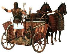
Max Müller, père de la mythologie comparée, tout comme Friedrich Schlegel, pensa avoir retrouvé le nom de ce peuple en se basant sur celui que se donnaient Perses et Indiens. Les premiers se nommaient Airya, et le nom même d’Iran désignait leur pays (farsi Erenvaj), et les seconds Arya. Ce terme signifiait « noble ». Pensant le retrouvant chez les Irlandais où on retrouvait le terme de Aire, Müller et plusieurs autres décidèrent de nommer ce peuple à partir de ce nom ancestral, et les Indo-Européens devinrent les « Aryens ». Ce nom finit par devenir odieux lorsqu’il fut instrumentalisé jusqu’à l’extrême par un régime de sinistre mémoire. Après 1945, le terme de « aryen » devint tabou, réservé à l’usage de nostalgiques du dit régime. Et « Indo-Européens » réapparut. Georges Dumézil, le brillant savant et spécialiste de nos vieilles mythologies d’Europe de l’époque d’avant Constantin, donna à ce dernier terme ses lettres de noblesse.

Mais cela ne nous éclairait pas davantage sur le nom originel, sur l’auto-ethnonyme, pour user d’un terme plus savant, de ce peuple. C’est alors qu’on se rendit compte que la comparaison entre l’Inde et l’Irlande n’était pas si incongrue. Si l’irlandais « aire » et le sanscrit « arya » n’avaient aucun rapport, tel n’était pas le cas de deux figures marquantes de leur mythologie respective. Le dieu indien Aryaman, garant des valeurs « arya », qu’on retrouve aussi sous le nom de l’ange zoroastrien Airyaman (Erman), existait en Irlande. Il s’y nommait Eremon. Et le si mystérieux dieu germanique Irmin était sans doute son homologue. Le lien était fait. Si un dieu *Aryomen avait existé à l’époque indo-européenne indivis, alors c’est que les Indo-Européens se nommaient tout simplement les *Aryōs, leur nom provenant sans doute d’une racine *ar- signifiant « être en forme ». Ils étaient donc les « bien formés », les « bien nés », les « nobles ».

Et c’est ainsi qu’une hypothèse de travail dans l’esprit de quelques brillants cerveaux de l’Europe du XIXème siècle devait se révéler féconde, un siècle et demi après. La tribu des *Aryōs était sortie de la préhistoire d’où elle avait disparu pour retrouver une étonnante place au cœur de l’Europe moderne. Une fois écartés les faussaires qui en avaient fait un si odieux usage, leur nom pouvait réapparaître. Ainsi en a-t’il été de ce peuple ancestral.

Une fois que ces *Aryōs furent redécouverts, la comparaison du vocabulaire commun et de la mythologie entre les langues-filles de leur langue-mère permit de reconstituer leur société, leurs valeurs, leurs coutumes et traditions, leur niveau de technologie, leurs institutions.

Les *Aryōs avaient inventé une forme de proto-démocratie, l’assemblée du peuple *sebhos (voir la Seimas lituanienne) se réunissait régulièrement et décidait des choses de la tribu. Ce n’est donc pas Sparte qui était la plus fidèle à cette tradition mais bien Athènes. C’était l’Ecclesia avant l’Ecclesia. Bien sûr il existait ce qu’on nommera un roi, le *regs, qui était le président élu de cette assemblée, le garant du droit, le prêtre suprême et le chef des armées. Ce *regs n’était pas un monarque oriental, mais une sorte de président. Le traduire par « roi », même si ce terme vient du sien, est une traduction inappropriée. Il existait peut-être un second chef, le *deuks ou « meneur », lui aussi élu. Cette idée aurait été conservée par Rome avec ses deux consuls et par Sparte avec ses deux rois, l’un devant rester à Sparte et l’autre menant son armée.

Le citoyen (*keiwos) participait donc dès le départ à la vie de la tribu, puis de la cité, et était l’égal de son voisin. Il n’existait probablement pas des castes comme en Inde, contrairement à une idée souvent reçue. Le schéma trifonctionnel indo-européen démontré par Dumézil (souveraineté, guerre, production) n’avait pas de transposition réelle. L’existence d’un clergé ou collège sacerdotal de « très sachant » (le sens du mot celtique « druide ») est controversée, même si le prêtre indo-européen ou *bhlagmen (latin flamen, sanscrit brahman) existait bel et bien. Difficile de savoir si cette fonction était sacerdotale comme chez les Celtes et les Slaves, ou élective comme les godar germaniques et les prêtres du Latium et de Grèce.

Ce citoyen était un soldat et un paysan. Il alternait l’épée et la charrue selon les périodes de l’année. Le vieux romain du temps de la république se serait certainement reconnu dans son ancêtre indo-européen. Les Indo-Européens avaient domestiqué le cheval, qui leur donnait l’ascendant au combat, et tous les animaux d’élevage traditionnel. Le porc (*sus) avait notamment un rôle important, et sa possession était un signe de richesse. Des troupeaux de bœufs (*gwous) ou d’ovins (*owis) étaient conduits de pâturage en pâturage par les ancêtres indo-européens des cow-boys, les *poymenês ou « bergers ».

Les *Aryōs étaient probablement installés en cités (*wastu) autour d’une colline où était établie une citadelle (*pelis). Ils n’étaient pas des nomades, encore moins une aristocratie guerrière imposant sa domination à des peuples étrangers. Sans la technologie moderne, sans l’écriture certes, ils ne différaient pourtant guère de nous. Européens avant que le mot même n’existe.

andronovochariotsm.jpgLeur religion était celle d’hommes libres. Les dieux étaient honorés autour de sanctuaires de bois,  avec des « idoles » de bois pour les personnifier et servant d’objet intermédiaire pour les contacter. Tous savaient que les dieux vivaient au ciel (*akmon, un « ciel de pierre ») et pas dans des sculptures. Ils possédaient sans doute des temples de bois (*temenom) réservés aux prêtres. Les figures divines étaient aussi bien masculines que féminines, sans que les unes aient un ascendant sur les autres, à l’exception du ciel-père (*dyeus) et de la terre-mère (*dhghōm), son épouse. Le rapport entre l’homme et le dieu n’était pas celui entre un esclave et son maître, mais entre amis, même si l’un était mortel et l’autre immortel. Les dieux se mêlaient aux mortels et parfois s’unissaient à certains d’entre eux, faisant naître des héros et des protecteurs. Ils n’avaient pas besoin de créer un mot comme « laïcité » car ils l’étaient par nature.
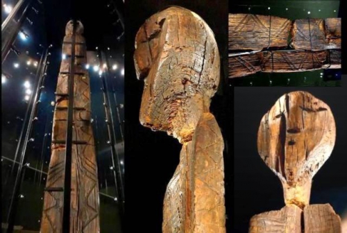
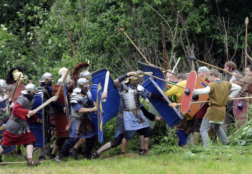
Les *Aryōs se méfiaient en effet de la magie et de toutes les spéculations métaphysiques. Leur bon sens les faisait préférer une religion simple avec de grandes figures divines préposées à des fonctions spécifiques. Il aurait été aberrant d’honorer la déesse de la terre avant d’aller au combat ou le dieu du ciel pendant qu’on ramassait les récoltes. Le rite avait au moins autant d’importance que la foi. Le contrat signé entre les dieux et les hommes devait être renouvelé. Et si les dieux étaient courroucés, comme lorsqu’un protecteur puissant vous fait défaut, il fallait les apaiser en sacrifiant des animaux d’élevage, tout en conservant les bons morceaux pour les hommes. Les dieux devaient se contenter d’humer l’odeur de la viande brûlant sur l’autel du haut de leur royaume céleste. Ils étaient modernes dans une époque qui ne l’était pas. Et c’est ainsi qu’ils purent être à la source de trois grandes civilisations (Europe, Perse, Inde) qui rayonnent encore aujourd’hui. Les mots « démocratie », « république », « laïcité » ou « égalité » leur étaient inconnus. Mais ils les vivaient.

Thomas FERRIER (LBTF, Le Parti des Européens)

jeudi, 21 janvier 2016

Carnuntum - Weltstadt im Land der "Barbaren"

Carnuntum - Weltstadt im Land der "Barbaren"

Der römische Offizier und Historiker Villeius Paterculus berichtete sechs nach Christus, dass ein unter dem Feldherrn Tiberius stehendes römisches Heer sein Winterlager im keltischen Königreich Noricum errichtete. Der genaue Ort der Niederlassung wird als "Carnuntum" bezeichnet. Das war die Geburtsstunde der legendären, römischen Großstadt im "Land der Barbaren", später auch als Klein-Rom an der Donau bezeichnet.

Mit 3-D-Animationen und Spielszenen wird das Leben und Treiben in der antiken Metropole wieder zum Leben erweckt.

Besonders ausführlich beschäftigt sich der Film mit den ganz alltäglichen Dingen des römischen Lebens vor 2.000 Jahren, die aus heutiger Sicht besonders interessant erscheinen. Wie hat die normale Zivilbevölkerung gelebt? Und wie der einfache Soldat? Was wurde gegessen und was wurde getrunken?

Antworten auf diese und viele Fragen mehr sind in den aufwendig inszenierten Spielszenen verpackt. Der Zuschauer erfährt, wie der so genannte "Puls", der Eintopf, in der römischen Armee zubereitet wurde, aber auch, was die so genannte High Society tafelte: Die Oberschicht Carnuntums genoss kulinarisch nahezu jeden Luxus. Sogar frische Austern, die man in salzwasserbefüllten Holzfässern von der Adria bis an die Donaumetropole transportierte, standen auf der Speisekarte. Doch nicht nur "was" gekocht wurde, sondern auch "wie" gekocht wurde, zeigt der Film in hyperrealistischen Bildern.

mardi, 27 octobre 2015

Russia’s Urals region might hold the key to Europe’s ancient origins

shigir.jpg

Russia’s Urals region might hold the key to Europe’s ancient origins

In August 2015, the Shigir Idol was recognized  as the world’s oldest known wooden sculpture. Prominent dendrochronologists and archeologists established that the statue is 11,000 years old, dating to the start of the Holocene period at the end of the last Ice Age and beginning of the present era.

The scientific community will probably have to revise the prevailing opinion that almost everything, starting from crop farming to philosophical perceptions of the world, was brought to Europe by ancient Middle Eastern farmers.

Mikhail Zhilin, a leading researcher at the Russian Academy of Science’s Institute of Archeology, is convinced that hunter-gatherers who lived in the Urals and Siberian forests 11,000 years ago exhibited a high level of development. “They lived in harmony with the environment and knew far more about it than modern people can imagine,” Zhilin told RBTH.

The mystery of the idol: a seventh drawing

In 2014 Professor Thomas Terberger, head of research at the Department of Cultural Heritage of Lower Saxony (Hannover), proposed an independent analysis of the Shigir Idol. He wanted to establish the age of the sculpture using the most advanced equipment available, and tests subsequently showed that the idol was older than previously thought, in fact dating to 11,000 years ago.

Dendrochronologists at the German Archeological Institute in Berlin established that the idol was made out of freshly-cut Siberian larch. The tree was at least 157 years old when the ancient craftsmen began to work on it.

Prof. Terberger believes the Shigir Idol is one of the most outstanding Eurasian cultural  masterpieces of the Stone Age. “Based on our studies, one can boldly assert that the development of Eurasian culture was driven not only from the Middle East but from other equally developed centers, in particular, from the Urals,” Terberger said.

Furthermore, scientists recently discovered a seventh mysterious drawing on the idol’s back side, which can be seen only with the help of a microscope. Previously, only six drawings were known. There are markings carved on the idol that depict a series of figures, with a total of eight characters. Their meaning remains a mystery, as well as many other of the idol’s secrets – what it was made for, and with what tools.  

How the idol was discovered and studied

The Big Shigir Idol was discovered in 1890 in a peat bog halfway between Yekaterinburg and Nizhny Tagil. At that time, the area was known for its gold mine. During excavations many ancient artifacts of the Shigir peat bog were lost but some were preserved, such as Stone Age bone arrowheads.

The idol was retrieved from the bog piece by piece, and when they were assembled it turned out they form a sculpture 5.3 meters tall, covered with mysterious carvings. Later, the lower part of that archeological wonder (about 193 cm long) was lost. The gold mine’s owner, Count Alexey Stenbok-Fermor, handed over the idol to the Urals Natural Sciences Society, today known as the Sverdlovsk Region History Museum.

Russian scientists first began to study the idol in 1997, and with the help of radiocarbon analysis they established that the idol was at least 9,500 years old. That announcement caused quite a stir, and skeptics suggested somebody had taken a larch lying in a peat bog for 3,000 or 5,000 years and made an idol out of it. Still, scientists knew that the idol would reveal more secrets.

“We were convinced that it was originally made out of a freshly-cut tree because we know how quickly wood taken out of a peat bog becomes dry and deformed, leaving it practically useless for making a sculpture,” said Svetlana Savchenko, a research associate at the Sverdlovsk Region History Museum.

Read more:

Ancient petroglyphs in the Russian North covered with a glass dome>>>

Russia’s 12 oldest ancient monuments>>>

Arqueólogos alemanes encuentran el campamento de Varus en Germania

PHO-09Jun12-165511.jpg

Arqueólogos alemanes encuentran el campamento de Varus en Germania


Ex: http://www.abc.es
 
Los arqueólogos de la Universidad de Osnabrück que están realizando las excavaciones
 

Si los alemanes beben cerveza en lugar de vino, aliñan con mantequilla y no con aceite de oliva, o siguen hablando una lengua endiabladamente hostil a los herederos del latín es porque nunca fueron romanizados. Y se lo deben a Arminio, un líder germano que contuvo a las legiones e impidió la creación de una provincia romana en la margen derecha del Rin. La gesta de Arminio, sin embargo, se ha mantenido a lo largo de los siglos en la niebla del mito nacional germánico, puesto que el único testimonio arqueológico de su victoria era una piedra funeraria con el nombre del centurión Marcus Caelius y una inscripción que documenta que murió en la Batalla de Varus. Ahora, el reciente hallazgo arqueológico de un campamento romano en Baja Sajonia arroja una primera luz científica sobre la leyenda y ayuda a redibujar el mapa de la historia romana de Alemania.

Se trata de un campamento romano de tiempos de Cristo en lo que hoy es Wilkenburg, al sur de Hannover, en el que según los primeros indicios llegaron a concentrarse al menos durante unos cuantos días unos 20.000 soldados romanos fuertemente armados, lo que equivale a tres legiones y a una décima parte del total de las tropas del imperio. Es el primero de su tipo hallado en el norte de Alemania y concretamente estuvo ocupado, según las primeras mediciones, entre el año 12 a.C. y el 9 d.C.. Desde él parten además, en varias direcciones, rutas de 20 kilómetros en las que se encuentran otros pequeños campamentos auxiliares. Junto a restos de sandalias romanas, pinzas y fíbulas, en total vario cientos de objetos y restos, han sido halladas monedas de la época del emperador Augusto. Hay denarios romanos acuñados en Lyon y otras monedas de origen celta. Su pormenorizado estudio aportará precisión al descubrimiento, mientras el trabajo de campo ha cumplido ya sus primeros objetivos.

Fueron unas imágenes aéreas lo que llamó la atención de los arqueólogos estatales del Land de Baja Sajonia y comenzaron las excavaciones en un área de 500 por 600 metros. Harald Nagel, afanado en el repaso con detectores de metales de unas 30 hectáreas de terreno, se muestra prudente en su valoración del hallazgo. «Los estudios de las monedas están todavía en su fase preliminar y es pronto para sacar conclusiones», dice, pero reconoce que «el yacimiento demuestra que Hannover y sus alrededores fueron un punt de importancia histórica y estratégica muy superior a lo que se estimaba hasta ahora».

Al igual que las legiones de Varus, los trabajos arqueológicos han de vérselas con constantes y copiosas lluvias que convierten las trincheras de excavación en auténticos barrizales cada dos por tres. «Tácito ya describió sobre la batalla de Varus que llovían perros y gatos», recuerda el arqueólogo Hening Hassmann, que destaca el cruce de rutas norte-sur y este-oeste que fue elegido para instalar a las tropas romanas.

En efecto, en 1515, el humanista Ullrich von Hutten descubrió en el primer libro de los Anales de Tácito una referencia a «Arminius», de quien el historiador romano decía que había infligido una derrota a Roma cuando el imperio estaba en todo su esplendor. Tácito calificaba a Arminius como el verdadero liberador de Germania. Ullrich von Hutten tomó las lacónicas apreciaciones de Tácito sobre Arminius y publicó en 1529 un diálogo póstumo titulado «Arminius», que cultivaron los los protestantes para subrayar la independencia no ya ante la Roma imperial sino ante la iglesia romana.

Hay consenso entre los historiadores sobre que Arminio, un germano que había formado parte del ejército romano y en quien Varus confiaba, formó una alianza entre varias tribus bárbaras y le tendió una trampa a Varus para hacerse con el control de la región. Las legiones romanas sucumbieron a una emboscada que terminó en carnicería. El actual hallazgo, por su importancia y dimensiones, apunta por ahora solamente a dos posibles lecturas: o bien el mismo Tiberio subió más al norte de lo que se había pensado hasta ahora, o fue Varus el que llegó hasta Hannover para allí morir y poner fin a la expansión romana en Germania.

lundi, 24 août 2015

Iliad Book 23 - Read by Dr. Stanley Lombardo

The Iliad Book 23 (62-107)

Read by Dr. Stanley Lombardo

A reading of Iliad Book 23, Lines 62-107 in Greek, by Dr. Stanley Lombardo, University of Kansas. Achilles is visited in a dream by the dead Patroclus. This is a particularly beautiful reading by Dr. Lombardo of a beautiful and emotional passage. To read along in Greek: http://www.perseus.tufts.edu/hopper/t...

Dr. Lombardo's translation of this passage:

When sleep finally took him, unknotting his heart
And enveloping his shining limbs—so fatigued
From chasing Hector to windy Ilion—
Patroclus' sad spirit came, with his same form
And with his beautiful eyes and his voice
And wearing the same clothes. He stood
Above Achilles' head, and said to him:
"You're asleep and have forgotten me, Achilles.
You never neglected me when I was alive,
But now, when I am dead! Bury me quickly
So I may pass through Hades' gates.
For the spirits keep me at a distance, the phantoms
Of men outworn, and will not yet allow me
To join them beyond the river. I wander
Aimlessly through Hades' wide-doored house.
And give me your hand, for never again
Will I come back from Hades, once you burn me
In my share of fire. Never more in life
Shall we sit apart from our companions and talk.
The fate I was born to has swallowed me,
And it is your destiny, though you are like the gods,
Achilles, to die beneath the wall of Troy.
And one more thing, Achilles. Do not lay my bones
Apart from yours, but let them be together,
Just as we were reared together in your house
After Menoetius brought me, still a boy,
From Opoeis to your land because I had killed
Amphidamas' son on that day we played dice
And I foolishly became angry. I didn't mean to,
Peleus took me into his house then and reared me
With kindness, and he named me your comrade.
So let one coffer enfold the bones of us both,
The two-handled gold one your mother gave you."
And Achilles answered him, saying:
"Why have you come to me here, dear heart,
With all these instructions? I promise you
I will do everything just as you ask.
But come closer. Let us give in to grief,
However briefly, in each other's arms."
Saying this, Achilles reached out with his hands
But could not touch him. His spirit vanished like smoke,
Gone under the earth, with a last, shrill cry.
Awestruck, Achilles leapt up, clapping
His palms together, and said lamenting:
"Ah, so there is something in Death's house,
A phantom spirit, although not in a body.
All night long poor Patroclus' spirit
Stood over me, weeping and wailing,
And giving me detailed instructions
About everything. He looked so like himself."
(Full book: http://www.amazon.com/Iliad-Homer/dp/...)

vendredi, 08 mai 2015

Arkaim — The Russian Stonehenge

Arkaim — The Russian Stonehenge

Arkaim

IN THE MODERN Russia, perhaps, you can’t find another archaeological site, which would exhibit such interest to itself by refined intellectuals, various politicians and the media. The Arkaim has spawned many myths – but still a little over ten years ago, nobody knows about it, even professionals. (ILLUSTRATION: Arkaim with a bird’s-eye view)

Unplanned opening of the Arkaim

It all started very modestly. In the summer of 1987, archaeologists of the Chelyabinsk State University conducted a routine survey of archaeological sites in the Big Karagansk Valley, in the south-west of the Chelyabinsk region.

It was expected to flood the valley to stage a vast reservoir for neighboring farms. The builders hurried, and archaeologists were in a hurry to descendants  make a map of the ancient monuments and never to come back here. But researchers have attracted the attention of trees, which, as it turned out, was surrounded by an unusual type of settlement – such has never been in the steppe zone.

It was about the diameter of a circular fortified settlement of about 150 meters, which included dozens of residential half-underground houses with the centers, cellars, wells and Steel Mining. The entire complex, called Arkaima, was originated in the 17 – 16th centuries BC. – It was hard to believe it!

the-map-of-Arkaim

The Map of Arkaim

He did not have to remain in splendid isolation – in a short time, archaeologists have discovered at least two dozen of these rounds or rectangular mounds, located in the Chelyabinsk and Orenburg regions, as well as in Bashkortostan and Northern Kazakhstan. All of them, on the assumptions of archaeologists, originated in 18th – 16th century BC!

What is surprising in all this? In recent decades, the world of science erupted again interest in the Indo-European issues: Where is the homeland of the Indo-Europeans, what was their ancient culture and how it has evolved, which hosted the migration routes of their individual groups.

Many of the Soviet archaeologists were convinced that the main settlement area of ​​early Indo-Europeans was the steppe and forest-steppe of Eurasia, where the Late Stone Age and the Bronze Age cultures were formed predominantly pastoral population, subsequently gave rise to the great cultures of the Scythian world.

According to many experts, the Arkaim and related sites could be created by ancient Indo-Iranians long before their separation, relocations over the Eurasian steppe and traffic corridor to the south of Iran and India.

Some of the scientists have drawn parallels between the circular fortified settlements such Arkaima and the city of the legendary king Yima reproduces the model of the universe and described in “Avesta” – the sacred book of the ancient Iranians.

The Arkaim’s Architecture

Arkaim is not only a city, but also a temple and an astronomical observatory! It has a circular shape, an outer diameter of approximately 160 meters. Surrounded by his 2 meter bypass ditch, filled with water. The outer wall is very massive. At a height of 5.5 m, it was a five-meter wide. There were identified four inputs on the wall. The largest – south-west, the other three – a little less, located on opposite sides.

the-plan-of-Arkaim

The Plan of Arkaim

Entering the city, we can find ourselves on a single circular street, of a width of about 5 meters separating adjacent to the outer wall of the dwelling from the inner ring of walls.

Street had a log deck, under which, along its entire length was dug 2-meter ditch communicating with the external bypass ditch.

Thus, the city had a storm sewer – excess water seeping through corduroy, fell into a ditch and then into the outer bypass ditch.

All the dwellings adjacent to the outer wall like a slice of lemon, had access to the main street. It was discovered 35 houses out of the circle.

Next, we can see a mysterious ring on the inner wall. It was even more massive than the outer. With a width of 3 meters, it reached a 7-meter height.

the-reproduction-of-Arkaim-1024x768

The Reproduction of Arkaim

This wall, according to the site does not have the passage, except for a short break in the Southeast. Thus, the 25 domestic dwellings of identical dwellings of the outer circle, are effectively isolated from all high and thick walls.

To come to the little door of the inner ring, you had to go through the entire length of the circular street. This is pursued not only a defensive purpose, but also had a hidden meaning.

Inbound to the city had to take the path that passes the Sun. Apparently, in a well-protected inner circle were those who possessed something that should not even show her living in the outer circle, not to mention the external observers.

And finally, the crowning Arch central area of ​​almost a square shape, about 25 by 27 meters.

Judging from the remains of fires in a given order, it was the area of ​​the commission of certain sacraments.

Thus, we see a schematic Mandala – a square inscribed in a circle. In the ancient cosmogonies texts circle represents the universe, the square – Earth, our material world.

The ancient wise man, knowing only appliance space, seen as perfectly natural and it works. Therefore the construction of the city as it – is a re-created the universe in miniature.

Also impressed with the engineering genius of the ancient builders. The Arkaim was built on a pre-engineered plan as a single complicated complex, and oriented to astronomical objects with great accuracy!

The figure formed by four entrances in the outer wall of Arkaim is a swastika. And it is the “right” swastika, it aimed at the sun.

Arkaim as an ancient observatory and its similarity with The Stonehenge

Very curious findings of the famous Russian astronomical-archaeologist Konstantin Bystrushkin., which conducted research Arkaim as an astronomical observatory in 1990-1991.

As Konstantin described, Arkaim – the construction is not just difficult, but even sophisticated complex. In the study the plan, Konstantin immediately found his resemblance to the famous monument of Stonehenge in England.

For example, the diameter of the inner circle of Arkaim indicates all of 85 meters, in fact it is a ring with two radii – 40 and 43.2 meters. (Try to draw!)

Meanwhile, the radius of the “Aubrey holes” ring, at Stonehenge – 43.2 meters! The Stonehenge, and the Arkaim are located on the same latitude, both in the center of a bowl-shaped valley. And between them are almost 4,000 kilometers …

Summing up all the facts obtained, we can say: Arkaim is a sub-Horizont Observatory. Why sub-Horizont? Because the measurements and observations used the moment of sunrise and sunset luminaries (Sun and Moon) to the horizon.

And pinpoint the time of “separation” (or touch) the lower edge of the disc, which allows the most accurate pinpoint location of the event. If you watch the sunrise, we note that the point of sunrise each day will move from its previous location.

Reaching the maximum north on June 22, this point then moves south, reaching to the other at the level of December 22. This is the cosmic order.

The number is clearly visible points of observation of the Sun – four. Two – the point of sunrise on June 22 and December 22, and two of the same points of call – on the other side of the horizon. Add two points – the moments of the equinox on March 22 and September 22. This gave a fairly accurate determination of the length of the year.

The Sources: The Library of the Alternative History, The Skeptik

Translated by: Alex Cardo

* * *

Source: Traveling Myself

00:05 Publié dans archéologie | Lien permanent | Commentaires (0) | Tags : arkaîm, russie, archéologie, préhistoire, proto-histoire | |  del.icio.us | | Digg! Digg |  Facebook

mardi, 24 mars 2015

L'art du vin grec

dio4364771.jpg

L'ART DU VIN GREC: Quand il a conquis les Celtes

François Savatier*
Ex: http://metamag.fr
 
Les objets découverts dans l'extraordinaire tombe princière celte de Lavau nous renseignent sur la façon dont les Celtes ont commencé à boire du vin : à la grecque !

Qui eût cru cela encore possible ? La « tombe à char » celte fouillée par  Bastien Dubuis et son équipe de l’INRAP à Lavau, près de Troyes, s'avère d'une importance comparable à celle de la princesse de Vix ! Située à deux kilomètres de la Seine, la chambre mortuaire de 14 mètres carrés a déjà livré un char à deux roues, deux céramiques, un poignard et son fourreau ainsi que de très nombreuses traces de bois et de tissus. Toutefois, c’est l’extraordinaire service à boire qui lui confère son rang de découverte exceptionnelle et invite les archéologues à penser qu’elle date du début du Ve siècle avant notre ère.


La pièce maîtresse du dépôt funéraire est un chaudron en bronze de près d'un mètre de diamètre, ce qui rappelle la tombe de Vix, où se trouvait un énorme cratère en bronze. Le bord du chaudron est décoré par huit têtes de félins, tandis que ses quatre anses circulaires sont ornées de têtes d’Acheloos, l’esprit-dieu du fleuve grec Achéloos. Au centre du chaudron se trouve une ciste, c'est-à-dire un contenant à objets sacrés qui est l’un des éléments bien connus du culte de Dionysos, le dieu du vin et… de ses excès. La ciste de Lavau a la forme d'un seau cylindrique en bronze. Un vase de bronze – un contenant à liquide selon Bastien Dubuis – se trouve aujourd'hui dans cette ciste, mais la stratigraphie (l'ordre des strates archéologiques) indique qu'il se trouvait à l'origine dans, ou sur le chaudron. Finalement, une œnoché (œnochoe), c'est-à-dire une cruche utilisée dans le rite dionysiaque pour puiser le vin, se trouve au fond du chaudron, accompagnée d'une passoire en argent destinée filtrer le liquide.

 
L’intérêt intrinsèque du chaudron et des objets qu'il contient est dépassé par celui de la seule œnochoé. Une œnochoe, littéralement, une « puiseuse à vin », est une cruche à panse large, à une seule anse et à bec verseur trilobé. Généralement en céramique, les œnochoés peuvent aussi être en métal, et être décorées ou non. La décoration de celle de Lavau met en scène Dionysos couché sous une vigne (une grappe de raisin est visible, ainsi que ce qui semble être du lierre) et parlant à une femme. Pour Dominique Garcia, président de l'INRAP, cette femme pourrait être Ariane, une mortelle censée avoir épousé Dionysos. Pour Bastien Dubuis, en revanche, ce pourrait être Déméter, la déesse grecque de l'agriculture et des moissons, souvent représentée avec Dionysos sur les œnochoés. Les deux personnages sont représentés par des figures noires sur fond rouge, un type de céramique produit dans la région d’Athènes jusqu'à la moitié du Ve siècle avant notre ère.

Pour Dominique Garcia, il est vraisemblable que l’œnochoé de Lavau a été importé de Grèce en Italie, où un habile artisan a recouvert le bord verseur et le pied d’une couche d’or agrémentée de filigranes. Cet artisan se serait employé à «customiser» un objet de luxe fréquent, peut-être même produit en série, pour s'adapter aux goûts celtes. En faisant travailler cet artisan spécialisé, le marchand méditerranéen qui a vendu ou offert le service à boire de Lavau à un prince celte aura ainsi cherché à s'adapter aux goûts exotiques des Celtes, un peu comme les marques de luxe françaises adaptent aujourd'hui des produits bien français aux goûts orientaux ou asiatiques…

Pour Bastien Dubuis, cette hypothèse, qui correspond à ce que l'on sait de la circulation des biens de luxe entre les peuples antiques, est séduisante, mais les princes celtes, grands amateurs de joaillerie, ont aussi pu faire appel sur place un artisan étrusque ou ibère. Peut-être cet artisan a-t-il est-il aussi l'auteur du magnifique torque (collier en forme d'anneau) décoré de chevaux ailés et d'une sorte de filigrane retrouvé dans la tombe de la princesse de Vix ? La tombe de Vix et celle de Lavau sont en effet très proches dans le temps et l'espace, et les relations entre ces deux tombes devront être étudiées en détail.

Quoi qu’il en soit, au début du Ve siècle avant notre ère, c'est-à-dire de la fin du Hallsttatt ou premier Âge du fer (de 800 à 450 avant notre ère), un prince celte (Lavau) et une princesse celte (Vix) se sont fait enterrer avec un service à boire destiné à célébrer les rites grecs de l'orgie dionysiaque. Or selon les indices archéologiques, l'élite celte ne connaissait pas le vin avant sa rencontre avec les marchands méditerranéens. Le fait qu'elle semble avoir repris à son compte le rite dionysiaque suggère qu'elle était en voie d'acculturation en reprenant les usages grecs. À moins que les élites celtes aient possédé depuis longtemps leur propre version des célébrations orgiaques grecques, de sorte que sous l'impulsion de marchands héllénisés, la mode du luxe grec se serait imposée aux élites celtes à la fin du Hallstatt. Une seule chose est sûre, tranche Dominique Garcia, cet œnochoe ornementé d’or et de filigranes est unique au monde. Le kitsch du luxe, c'est sûr, est très ancien.

Pour en savoir plus :

Michael Dietler, L'art du vin chez les Gaulois, Dossier Pour la Science N°61, octobre-décembre 2008.
François Savatier, Le trésor du Keltenblock, actualité Pour la Science, en ligne le 4 avril 2012.
Stéphane Verger, La Dame de Vix : une défunte à personnalité multiple, dans J. Guilaine (dir.), Sépultures et sociétés. Du Néolithique à l’Histoire, Paris 2009, p. 285-309.

00:05 Publié dans archéologie | Lien permanent | Commentaires (0) | Tags : archéologie, gaule, grèce antique, oenologie, vin, vin gaulois | |  del.icio.us | | Digg! Digg |  Facebook

mercredi, 11 mars 2015

Découverte exceptionnelle d'une tombe princière celte dans l'Aube

aube_1ed87def46d1094c2b220e6dedf144e6.jpg

Découverte exceptionnelle d'une tombe princière celte dans l'Aube

 
Ex: http://anti-mythes.blogspot.com
Une tombe princière celtique du Ve siècle avant notre ère, riche d'objets grecs et sans doute étrusques, a été découverte dans une zone artisanale et commerciale près de la ville de Troyes (Aube). Il s'agit d'une trouvaille "exceptionnelle", a estimé mercredi l'Inrap (Institut national de recherches archéologiques préventives) qui fouille ce site depuis octobre à la demande de l'État. La tombe est située sur la petite commune de Lavau, à quelques kilomètres de Troyes.
Au centre d'un tumulus (monticule au-dessus d'une sépulture) de 40 mètres de diamètre, le défunt - qui n'a pas encore été dégagé - et son char reposent au coeur d'une chambre funéraire de 14 mètres carrés. "Il s'agissait probablement d'un 'prince' celte local", souligne Dominique Garcia, président de l'Inrap, en faisant visiter le chantier à la presse. "Une partie des objets est d'origine grecque et sans doute étrusque", relève-t-il.
Une tombe datant de la fin du Premier âge du Fer
4587455 6 a425 vue-aerienne-de-la-fouille-conduite-par a89a23910e14e88a4f617d475b259437La pièce maîtresse du dépôt funéraire est un grand chaudron orné en bronze, dans lequel on mettait du vin coupé d'eau. Il pourrait avoir été réalisé par des artisans étrusques. Il contient un pichet à vin (oenochoe) en céramique attique à figures noires, fabriqué par des Grecs. Ce mobilier "atteste des échanges qui existaient entre la Méditerranée et les Celtes", souligne Dominique Garcia. La tombe date de la fin du Premier âge du Fer (période dite du Hallstatt).
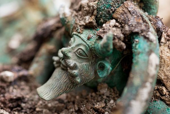
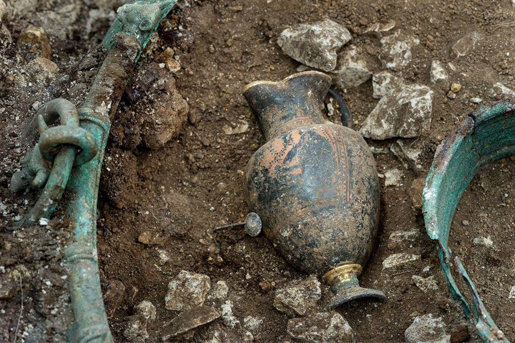
La fin du VIe siècle et le début du Ve siècle av. J.-C. ont été marqués par le développement de l'activité économique des cités-États étrusques et grecques d'Occident, Marseille notamment.
Les commerçants méditerranéens entrent en contact avec les communautés celtiques continentales. Celles maitrisant les voies naturelles de communication voient leurs élites acquérir de nombreux biens de prestiges dont les plus remarquables sont retrouvés enfouis dans de monumentales tombes tumulaires – à La Heuneburg et Hochdorf en Allemagne par exemple, à Bourges, Vix et maintenant Lavau.
B Ra3NnXIAASvlH 720833-capture-d-ecran-2015-03-04-a-193806.jpg
Source : Lci.tf1.fr

mardi, 17 février 2015

Redécouvertes des Europe chevelues

Card-012.jpg

L'APPEL AUX FORÊTS ENGLOUTIES
 
Redécouvertes des Europe chevelues

Jean Ansar
Ex: http://metamag.fr

Les légendes sont des mensonges qui nous parlent de vérités. Et les forêts des dieux anciens témoignent de la vivacité d’un continent peuplé de divinités variées au cœur de forêts aujourd’hui englouties et redécouvertes.


Dans la baie de Cardigan, sur la côte ouest du pays de Galles, les rafales de vent à répétition ont déplacé des milliers de tonnes de sables sur les plages, découvrant des dizaines de souches d'arbres vieilles de plusieurs milliers d'années. Il s'agirait, rapportent le Guardian et le Daily Mail, de la forêt préhistorique de Borth, où s'enracine la légende de "l'Atlantide galloise", le royaume englouti de Cantre'r Gwaelod, submergé après qu'une fée l'a délaissé. 


bay_map.jpgLes arbres seraient morts il y a plus de 4500 ans, au moment de la montée des eaux, mais auraient été préservés grâce à la constitution d'une couche de tourbe très alcaline où, privées d'oxygènes, les petites bêtes qui se chargent normalement de décomposer les arbres morts n'ont pas survécu, et donc pas pu faire disparaître ces souches. Le mythe, comme tant d'autres, est peut-être un souvenir collectif populaire laissé par la montée graduelle du niveau de la mer à la fin de la période glaciaire ; sa structure est comparable à la mythologie du Déluge comme tant d'autres que l'on retrouve dans pratiquement tous les cultures anciennes. Les restes d'une forêt ancienne engloutie à Borth, et à Sarn Badrig, près de la, peuvent avoir suggéré qu'une grande tragédie pouvait avoir emporté une ville qui se trouvait la autrefois. Il n'y a pas encore d'évidence physique solide qu'une ville substantielle existait sous la mer dans cette région.
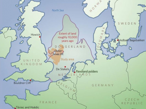

Plus récemment encore, l’'océanographe Dawn Watson a fait de son coté une découverte des plus étonnantes : une forêt entièrement immergée dans la Manche, qui a été engloutie lors de la dernière fonte des glaces il y a environ 6000 ans. Avant d'être un fond marin, cette terre abritait un des terrains de chasse et de pêche les plus riches de toute l'Europe. Le niveau de la mer était alors plus bas d'une centaine de mètres par rapport à celui d'aujourd'hui.  «J'ai d'abord pensé que c'étaient des morceaux d'épaves», a déclaré Dawn Watson au journaliste de la BBC qui l'a interviewée. En réalité, il s'agissait de troncs d'arbre entièrement recouverts d'algues. D'après la scientifique, la tempête de 2013 ayant sévi près des côtes de Norfolk aurait permis la découverte de ces vestiges vieux de milliers d'années. C'est en plongeant au large de la côte du comté de Norfolk (Grande-Bretagne) dans la Mer du Nord, à quelques 200 kilomètres au nord-est de Londres, que l'océanographe britannique Dawn Watson a découvert une forêt préhistorique engloutie sous les eaux, s'étendant sur plusieurs milliers d'hectares.
Datée à environ 10000 ans, cette forêt était située sur une ancienne terre émergée connue des géologues sous le nom de Doggerland, qui reliait l'actuelle Grande-Bretagne au continent européen à l'époque des glaciations du quaternaire. Il faut savoir en effet que lors du dernier maximum glaciaire il y a un peu plus de 20000 ans, le niveau de la mer était plus bas qu'à l'époque actuelle, d'une centaine de mètres environ, ce qui faisait émerger une partie de la mer du Nord.

doggerland_530.jpg


Et c'est avec la fin de la dernière glaciation que l'eau a commencé à monter, pour atteindre son niveau actuel il y a 6000 ans environ. Résultat : l'étendue émergée du Doggerland, dont on pense qu'elle était autrefois fréquentée par les chasseurs-cueilleurs du Mésolithique (-10000 à -5000 ans avant notre ère, en Europe), a été engloutie sous les eaux. Et avec elle... la forêt découverte par l'océanographe Dawn Watson.


Selon Dawn Watson, cette forêt aurait été rendue visible à cause d'une forte tempête ayant touché la côte du comté de Norfolk, en décembre 2013. Il y a encore beaucoup à découvrir sur notre plus ancienne mémoire et l’origine des peuples des forets et des mers.

samedi, 14 février 2015

Can Syria’s Cultural Heritage be a Fulcrum for Ending its Civil War?

Krak_des_Chevaliers,_NW_Syria_-_3.jpg

We Can Help Stop the Destruction

Can Syria’s Cultural Heritage be a Fulcrum for Ending its Civil War?

by FRANKLIN LAMB
Ex: http://www.counterpunch.org

For visitors to Syria these days, certainly this one, it’s almost become a cliche to shake ones head and mumble, “this is not your normal civil war.” Meaning that in spite of the dangerous environment for families and enormous sacrifices being paid daily, the Syrian people go about their lives with amazing resilience.

Yesterday, 2/5/15, was the latest example. Rebel mortars started raining on downtown at 7 a.m. after a rebel commander Zahran Alloush of the “Islam Army” tweeted that his forces would keep firing mortars and rockets “until the capital is cleansed.” An estimated nine people were killed, and dozens wounded in downtown Damascus from roughly 60 rebel mortars. By the end of the day more than seventy, most of them rebel forces, died as the Syrian army and rebel fighters trading salvos of rockets and mortar bombs.

Despite the bombardment, most office workers showed up for work, students arrived for classes at Damascus University, and the public schools were open although many were dismissed early. This observer had appointments at three different Ministries and only one person I was to meet stayed home because it was near the fighting and he chose not to tempt fate.

One government minister smiled knowingly when his visitor commented that between the Dama Rose hotel and his office, although the streets were at that point nearly empty and the sound of mortars was loud, the street cleaners and trash collectors were nonchalantly going about their work. Students of Syrian culture say examples such as this one reflect the deep and unique connections among Syrians for their country–present and past.
It is becoming commonplace, as the world learns more and becomes more distressed about Syria’s Endangered Heritage to speak of this country as the crucible or cradle of human civilization which spans hundreds of thousands of years. This country is home to some of the world’s first cities, as well as globally important sites from the Akkadian, Sumerian, Hittite, Assyrian, Persian, Greco-Roman, Ummayyad, Crusader, and Ottoman civilizations and to some of the oldest, most advanced civilizations in the world.

umayyad-mosque-500.jpg

The area saw our evolution – for example, at the Middle Acheulian occupation site at Latamne northern Syria between 800 – 500,000 years old, stone tools and possibly even early hearths have been identified as belonging to a civilization hundreds of thousands of years before modern humans evolved 120,000 years ago. 10,000 years ago, the first crops and cattle were domesticated in Syria and the subsequent settlements gave rise to the first city states, such as Ebla and Mari. Writing developed here and the creation of literary epics, art, sculpture, and the expansion of trade soon followed. At the crossroads of the Mediterranean, the destined to become modern Syria was invaded by the rise of the great Southern empires emerging from Ur, Bablyon, Assur, Akkad and Sumer. From the East the Persians invaded and occupied the area and then the Mongols and the Arabs. From the North came the Hittites and from the West, the Greeks, the Romans and the Byzantines to be followed by the Crusading forces of the Kings of Europe. Nomadic tribes, known from the Christian Bible, such as the Canaanites and Arameans, arrived and all conquered the area for varying periods and settled. For 400 years Syria was absorbed into the Ottoman Empire and her people revolted and occupation was passed to French after World War I until Syria finally achieved her independence following World War II.

Nowhere else has the world witnessed this complex and unique meeting of states, empires and faiths as Syria. Who can imagine that the great Umayyad Mosque in Damascus was originally a temple to Jupiter? Later converted to a Christian basilica to John the Baptist, and in turn became what some consider the fourth-holiest place in Islam.

Salahdin, the enemy of King Richard the Lionheart, is buried there. And as history continues to leave its ever-changing imprint, in the last thirty years UNESCO has declared six sites in Syria– Syria has 6 such sites including the ancient City of Damascus and a further 12 on the list for Tentative consideration on its World Heritage List. It is from this this rich and diverse history, that Syria’s people have a reputation for tolerance and kindness. Yet now this history, and the peace built upon it, is threatened as never before, and the cultural heritage of all of us, these cross-roads of civilization are quite literally caught in the cross-hairs of war.

Religion has also indelibly marked Syria. This observer has walked through some of the area where Abraham, who influenced three monotheistic religions, pastured sheep at Aleppo and gave the city its Arabic name – Halab. Other visits to religious landmarks have included the old city of Damascus and Straight Street, where tradition holds that the conversion of Saul to Paul the Apostle occurred. Shortly before the events of March 2011, mass was still being held in the house he reputedly inhabited almost 2,000 years ago. The head of the John the Baptist, cousin of Jesus, is said to be enshrined in the Great Mosque in Damascus. The village Maloula is amongst the last places in the world where Aramaic, the language spoken at the time of Jesus, can still be heard – part of a living, breathing, spoken history. Khalid ibn al-Walid, companion to the Prophet Muhammad, founder of Islam, is buried in Homs in his namesake mosque. Muhammad’s successors left a legacy of beautiful mosques: several are now part of World Heritage sites.

alep200904231345.jpg

When many of us ponder destruction of cultural heritage, we tend to think first of great monuments burning or blasted into rubble. Yet these monuments are about people, and it is with people that all discussions of heritage must begin and finish. Heritage is built by them. It is used and reused by them. Cultural Heritage is also about more than built structures, it is about the intangible beliefs and practices associated with them, and the values assigned to them, including those which may have no material manifestation at all. An analysis of the destruction of Syria’s cultural heritage necessarily encompasses many expressions.

This observer has experienced firsthand locations in Syria where heritage is sometimes at the forefront of the conflict, most notably in the Citadel and Al-Madina Souk in the heart of the Ancient City of Aleppo, a World Heritage site. Conflict in this area has been particularly heavy and damage extensive. The Citadel has taken on a symbolic status to those involved. To militarily control the Citadel is to own the heart of Aleppo, one of the oldest cities in the world.

Yet, ironic as it may seem at first brush, it is during conflict we often see the true, enduring power of heritage to heal and build peace. We have seen in Syria cases where after looters tried to break into the Museums or were caught doing illegal excavations, or trying to sell looted artifacts, that local citizens objected and in some cases risked their lives while confronting criminals and sometimes even blocking access to archeological sites. Such patriotic acts are not just about the protection of the past, but also about the present. We have seen in Syria that after a series of bombings at religious sites, Christians have protected Muslims so that their sisters and brothers can worship in peace, and Muslims in Syria do the same for Churches. These acts of solidarity in Syria, for Syria, are not only bringing the two communities closer together, but they resonates around the world, showing people that peace is possible, and that people of all faiths can work together and are even willing to risk their lives for one another for their shared past- for our shared past, and for each other’s beliefs.

But there is another view. Islamic jihadists have several times explained in great detail to this observer that they want to ruin the artifacts of non-Muslim civilizations, because doing so testifies to the truth of Islam. They always explain that the Qur’an suggests that ruins are a sign of Allah’s punishment of those who rejected his truth. Many were the Ways of Life that have passed away before you: travel through the earth, and see what the end was for those who rejected Truth. (Qur’an 3:137) This is one of the foundations of the Islamic idea that pre-Islamic civilizations, and non-Islamic civilizations, are all jahiliyya — the society of unbelievers, which is worthless. Scores of examples, including ISIS (Da’ish) destroying Assyrian statues and artifacts believed to be 3000 years old which they illegally excavated from the Tell Ajaja site. Museums at Apamea, Aleppo, and Raqqa experienced thefts, and the archaeological sites of Deir ez-Zor, Mari, Dura Europos, Halbia, Buseira, Tell Sheikh Hamad and Tell es-Sin have all been damaged by looters and as of February 2015, five out of six UNESCO world heritage sites in Syria have been damaged by war. Damage to sites like the ancient city of Aleppo and the ruins of Palmyra, Crac des Chevalier and so many others. Nowhere worse than the destruction of the minaret of al-Umayyad mosque in Aleppo in May of 2013.

Palmyre--Syrie_20060808135623.jpg

Daunting as the restoration and repairing these sites may appear, it is a crucial process to foster reconciliation while protecting the heritage that unites all Syrians. People need to rebuild trust and for that to happen, they must have shared memories together. It was a Syrian PhD student, who teamed up with a Dutch archaeology professor, who began documenting the damage to Syrian heritage sites shortly after March of 2011. Soon the work expanded to become a peace-building initiative across Syrian civil society. One of the most remarkable social society NGO’s, now doing many amazing projects is the Spain based Heritage for Peace. (www.heritageforpeace.org ) HFP, like several other private politically neutral groups are working on restoring and repairing these sites as a way to foster reconciliation and it has been achieving much, if on a small scale so far.

The local restoration and repair of damaged sites where security conditions allow will foster reconciliation. As archeological sites are rebuilt so will trust be rebuilt. This observer has experienced this inspiring phenomenon among officials, student volunteers, Syrian army personnel and even rebels. Participants in Syria’s civil war and regular citizens trying to survive the carnage need a basis to rebuild trust and shared memories matter. Hugely. They unite Syrians, pro or anti regime, Syrian locals who refused to leave their home or the three million ex-pats who have fled and want to come home.

The NGO, Heritage for Peace (HFP), is one among others that has studied the destruction in Syria and that believes that heritage can serve as a key focus of dialogue among communities and ethnic and religious groups who have been pitted against one another over the past four years. As part of this process, heritage can become scaffolding for constructing peace in Syria by concentrating on protecting cultural heritage and mitigating damage by galvanizing the public, both local and international, to support heritage protection. Studies show that when citizens caught up in civil war, a movement focused on protecting common cultural heritage fosters compatibility between communities and hastens the postwar phase. Protesting our shared cultural heritage in Syria is showing signs for becoming a peace-building initiative across civil society.

image47.jpg

And there is an important role for the global community. What needs to be done now to protect our cultural heritage in Syria which can also help end the conflict are the following measures which all of us can and must participate in. All people of good can work to promote the safeguarding and protection of our cultural heritage in Syria irrespective of religious or ethnic identity. To this end they hopefully will work for goals include the following:

*Document and preserve knowledge of the damages to cultural heritage in Syria during the present conflict while developing long-term policies to protect Syria’s heritage in conflict;

*Raise global awareness of the importance for Syria’s heritage of ending the fighting and stopping its destruction;

*Encourage the co-operation of national and international NGOs who are already working to protect Syria’s heritage and liaise with Syrian heritage workers operating during a current conflict; and the international heritage community;

*Raise global awareness of and campaign against the illicit trade in looted Syrian artifacts globally focusing on the neighboring countries Lebanon, Turkey, Iraq and Jordan and expose those dealers, auction houses and museums who profit from theft of our global heritage in Syria;

*Promote understanding across diverse communities in Syria of the communal value of heritage and encourage foreign archeologists who have previously worked in Syria to provide information and assistance during and after the conflict;

*Promote the return of tourism to Syria and assist in preparations for reconstruction and preservation in the post-conflict phase and the return of international archeologists.

We can help stop the continuing destruction of our global heritage in Syria by this solidarity work. And it can function as a sort of fulcrum to bring an end to Syrian conflict by demonstrating that the people of Syria, custodians of the past of all of us, value this heritage over politics or bizarre religious applications which command that our heritage be destroyed.

Franklin Lamb’s most recent book, Syria’s Endangered Heritage, An international Responsibility to Protect and Preserve is in production by Orontes River Publishing, Hama, Syrian Arab Republic. Inquires c/o orontesriverpublishing@gmail.com. The author is reachable c/o fplamb@gmail.com

jeudi, 12 février 2015

Mer du Nord. Découverte d’une forêt engloutie entre France et Angleterre

northsea.gif

Mer du Nord. Découverte d’une forêt engloutie entre France et Angleterre

Hervé HILLARD

Ex: http://www.ouest-france.fr

Une plongeuse scientifique vient de découvrir les vestiges de l'immense forêt engloutie voici 6 000 ans entre France et Angleterre. Une jolie promenade dans le temps.

Pas de ferry. Encore moins de tunnel sous la Manche. Pensez : pas de Manche du tout...

Voici 10 000 ans, le niveau de la mer était plus bas qu’aujourd’hui. Au moins 100 mètres plus bas.

Les hommes du Mésolithique pouvaient donc traverser à pied sec ce qui deviendra le Channel. Et installer des campements sur les sommets qui s’élevaient de la plaine entre Bretagne et Normandie, et qui deviendront Jersey, Guernesey, Sercq, Aurigny et Chausey.

Un cercle de pierres vieux de 5 000 ans

Chausey, où un cercle de pierres mégalithique a été découvert dans la vase voici quelques années, vieux d’environ 5 000 ans – et à l’époque évidemment réalisé sur ce qui était alors de la terre ferme.

Le cercle de pierres mésolithique découvert à Chausey, aujourd'hui posé sur la vase et recouvert à marée haute.

Voici 10 000 ans, en tout cas, une immense forêt couvrait la cuvette formée par la Manche, au fond de laquelle coulait un grand fleuve – la future Tamise.

Cette forêt, une plongeuse scientifique vient d’en découvrir des traces irréfutables.

mdnB8QzO8dIgAA3Uza.jpg

Troncs d'arbres et branches recouverts d'algues

A l'occasion d'une plongée, Dawn Watson, océanographe a fait une découverte surprenante, rapportée par le Washington Post : les vestiges de cette forêt, engloutie voici environ 6 000 ans.

« J'ai d'abord pensé que c'était des morceaux d'épaves », a expliqué Dawn Watson à la BBC. Avant qu'elle se rende compte qu'il s'agissait de troncs d'arbres et de branches recouverts d'algues.

Les géologues connaissent cette forêt qui, à une période de glaciation (donc de bas niveau des océans), se dressait entre la France et l'Angleterre sur une terre appelée Doggerland (voir l'illustration ci-dessous).

merdunordB8SYfeOIgAAf-qL.jpg

Un vrai « paradis »

« Il y a 10 000 ans, cet espace était un des plus riches en matière de chasse, de capture d'oiseaux et de pêche en Europe », raconte Bernhard Weninger de l'université de Cologne. On y trouvait « un bassin important d'eau de source, alimenté par la Tamise à l'ouest et par le Rhin à l'est », explique le scientifique, qui n’hésite pas à comparer l’endroit à un « paradis ».

Cette forêt a été peu à peu engloutie lors de la dernière fonte des glaces, il y a environ 6 000 ans. Qui a aussi submergé ce qui deviendra la baie du Mont-Saint-Michel, isolant les îles Anglo-Normandes et Chausey.

Mais au fait, pourquoi ces traces n'ont-elles été trouvées qu'aujourd'hui ? L'océanographe Dawn Watson pense que si les vestiges de la forêt sont désormais visibles, c'est grâce à une tempête qui a touché la côte du comté de Norfolk en 2013. Et qui permet, aujourd'hui, de se promener dans les bois.

Hervé Hillard

Ancient underwater forest discovered off Norfolk coast

Nature experts have discovered a remarkable submerged forest thousands of years old under the sea close to the Norfolk coast.
The trees were part of an area known as 'Doggerland' which formed part of a much bigger area before it was flooded by the North Sea.
It was once so vast that hunter-gatherers who lived in the vicinity could have walked to Germany across its land mass.
The underwater forest was discovered by Dawn Watson and Rob Spray from Sea Search on a diving trip to study marine life.
The prehistoric forest lay undiscovered until it was exposed by the extreme storms along the east of England coast in December 2013.
BBC Inside Out's David Whiteley reveals exclusive underwater footage of the submerged forest which experts believe could date back more than 10,000 years.

Diver finds 10,000 year old FOREST stretched as far as Europe hidden under the North Sea

Diver finds 10,000-year-old FOREST which originally stretched as far as Europe hidden under the North Sea Diver Dawn Watson found incredible ancient forest under the North Sea The 45-year-old discovered oak trees with eight-metre branches off Norfolk 10,000-year-old trees appear to have been hidden underwater since Ice Age Experts believe pre-historic forest uncovered during recent stormy weather Ms Watson said she was 'absolutely thrilled' with find off Cley next the Sea

A shocked diver has found an incredible 10,000-year-old pre-historic forest under the North Sea and experts believe it could have once stretched as far as Europe.

Diver Dawn Watson, 45, discovered the remarkable 'lost forest' when she was diving just 300 metres off the coast of Cley next the Sea, Norfolk.

She found complete oak trees with branches measuring eight metres long under the sea and experts believe they have been hidden off the coast of Norfolk since the Ice Age.

The forest is believed to have become exposed following the stormy weather last winter.

Ms Watson, who runs the Marine Conservation Society's survey project, Seasearch in East Anglia with partner Rob Spray, said she was 'absolutely thrilled' with the find.

She said: 'I couldn't believe what I was seeing at first.

'The sea was quite rough by the shore so I decided to dive slightly further out and after swimming over 300 metres of sand I found a long blackened ridge.

'When I looked more closely I realised it was wood and when I swam further along I started finding whole tree trunks with branches on top, which looked like they had been felled.

'It was amazing to find and to think the trees had been lying there completely undiscovered for thousands of years. You certainly don't expect to go out for a quick dive and find a forest.'

Ms Watson, who has been diving in the North Sea for about 16 years, said the trees are thought to have formed part of a huge forest, measuring thousands of acres.

But it is believed the forest was drowned when the ice caps melted and the sea level rose 120 metres.

The fallen trees are now lying on the ground where they have formed a natural reef, which is teaming with colourful fish, plants and wildlife.

I created this video with the YouTube Slideshow Creator (http://www.youtube.com/upload)

lundi, 02 février 2015

Un trésor gaulois vieux de 2300 ans!

guerrier-Gaulois.jpg

UN TRÉSOR GAULOIS VIEUX DE 2300 ANS
Une découverte à Roubion, dans les Alpes-Maritimes

Nice-Matin*
& http://metamag.fr

Quarante et une pièces de bronze datant de la Deuxième Guerre punique ont été découvertes dans le Mercantour au milieu des vestiges d’un sanctuaire gaulois. Les archéologues qui, l'été dernier, ont fouillé durant un mois le site de la Tournerie, à Roubion, n'imaginaient sans doute pas qu'ils allaient mettre au jour un véritable trésor !


Scientifiquement et historiquement les découvertes réalisées par ces chercheurs, à plus de 1.800 mètres d'altitude au cœur du Mercantour, étaient déjà inestimables. Leur travail a, en effet, permis d'exhumer un monumental sanctuaire gaulois datant de l'âge du fer.


Le crâne tranché d'un coup d'épée retrouvé à l'entrée du site qui, à l'époque, devait dissuader les intrus, n'a guère impressionné les archéologues. Ils ont fouillé avec minutie l'ensemble des lieux. Et entre les pierres qui soutenaient le lourd mur d'enceinte de 6 mètres d'épaisseur encerclant le sanctuaire, ils ont également trouvé le magot des Gaulois qui vivaient là !


41 pièces de bronze


Dans le plus grand secret c'est donc un trésor, monétaire cette fois, qui a été exhumé le 25 juillet dernier. Trois jours seulement avant que le chantier ne s'achève.
Le site archéologique de la Tournerie, à Roubion, repose désormais sous des milliers de mètres cubes de terre et les premières neiges de décembre. Mais cette chape de protection pour le moins dissuasive n'a pas suffi à contenir la rumeur qui, peu à peu, s'est emparée de la vallée de la Tinée.


Il y avait donc bien un trésor à la Tournerie : « Nous avons trouvé 41 pièces de bronze de 10 à 13 grammes chacune, confirme Franck Suméra, conservateur en chef de la région Paca. L'une d'entre elles, portant pour effigie la tête d'Athena, permet de dater l'ensemble après l'époque de la Seconde Guerre punique. C'est-à-dire entre 215 et 200 ans avant notre ère. Il n'y avait pour l'heure que trois trésors monétaires d'une telle ampleur découverts dans notre région, depuis le XIXe siècle, du côté de Montpellier et de Marseille. »


Influence massaliote


Dans les Alpes-Maritimes, il s'agit donc d'une première qui, bien sûr enthousiasme les chercheurs  : « C'est incroyable de découvrir en fouillant les montagnes du Mercantour un trésor qui nous renvoie directement à Carthage à Hannibal ! »


Mais aussi à Marseille, puisque le trésor découvert à Roubion serait d'origine Massaliote (Marseille antique). Voilà qui pourrait redessiner les contours la carte des influences géopolitiques.


Alors qu'on imaginait la région plutôt tournée à l'époque vers l'Italie ou les Alpes, il semblerait que les Gaulois du Mercantour entretenaient des relations commerciales avec leurs voisins phocéens.


De quoi faire sourire le président du conseil général qui a largement financé ce programme de fouilles : « Puisqu'il y avait déjà des relations avec Marseille à cette époque cela ne peut que nous inciter à les entretenir », souligne Eric Ciotti.


De manière, espérons-le, plus pacifié qu'au temps de nos ancêtres les Gaulois. Car, sur le site de la Tournerie, les archéologues ont également découvert des corps démembrés.
« Peut-être des trophées de guerre », explique Franck Suméra. Mais le site n'a pas encore livré tous ses mystères. Il faudra procéder à d'autres fouilles pour avoir une lecture précise de ces vestiges de notre Histoire.


« Nous continuerons à les financer, annonce d'ores et déjà Eric Ciotti pour qui ce « site majeur » est aussi « une source potentielle de développement pour notre territoire ».


Les fouilles devraient donc reprendre à la Tournerie dès l'été prochain. Non pas dans la perspective, peu probable, de découvrir un second trésor monétaire mais pour enrichir plus encore la connaissance de notre passé.


Des milliers de céramiques enfouies à Grasse


Une découverte archéologique peut en cacher une autre. Alors que le site de la Tournerie, à Roubion, hiverne en attendant que de nouvelles fouilles soient entreprises cet été, un autre chantier vient de s'ouvrir, à Grasse cette fois.


Le site était connu des archéologues depuis que les premiers coups de pioche de la future médiathèque Charles Nègre ont mis au jour les vestiges d'un passé que l'on ignorait.
Cette découverte fortuite à l'occasion des travaux a donné lieu à une première série de fouilles de juin 2013 à septembre 2014. Les archéologues pensaient alors être arrivés au bout de leur voyage dans le temps. Ils se trompaient.


60.000 tessons enfouis à 7 mètres sous le sol


Après avoir remonté les époques modernes puis médiévales, les chercheurs avaient buté contre une couche de roche. « Ce travertin constitue le sol naturel de la ville de Grasse, explique Fabien Blanc, l'archéologue qui supervise le chantier. Toutefois sa configuration nous avait intrigué. »


Les scientifiques ont donc décidé d'ouvrir des « fenêtres » dans la pierre pour voir ce qu'il y avait dessous. Et quelle ne fut pas leur surprise ! « Nous avons d'abord découvert du haut Moyen Âge qui avait été déplacé sans doute à la suite d'une catastrophe naturelle, un tremblement de terre ou des intempéries. »


La couche de travertin s'était, en fait, constituée par écoulement des eaux et masquait une occupation plus ancienne. Bien plus ancienne, car en fouillant plus profondément encore les archéologues ont trouvé un nouveau trésor. Celui-là n'est pas monétaire.


« A sept mètres sous le niveau actuel de la place nous avons découvert des tessons de céramique en très grande quantité datant d'il y a 1400 ans avant Jésus-Christ,relate Fabien Blanc qui s'est amusé à faire un petit calcul : « Sachant que nous n'avons pour l'heure ouvert que trois petites fenêtres dans le sol, si on extrapole aux 120 m2 du site on devrait extraire soixante mille céramiques sur à peine un mètre d'épaisseur. Une telle concentration serait réellement exceptionnelle. »


Pour s'en assurer il ne reste plus qu'à creuser. Les fouilles vont donc reprendre en janvier.


Gare aux pilleurs... de poussière


Le trésor monétaire de la Tournerie aura donc réussi à traverser 2 300 ans d’histoire. La valeur de ces quarante et une pièces de bronze est d’ailleurs plus historique que financière.
Pour les archéologues les éléments de découvertes (l’emplacement exact, le conditionnement, les autres objets à proximité), comptent d’ailleurs autant que la découverte elle-même.


C’est en réalité une carte du temps que les chercheurs mettent au jour. Et il suffirait que quelques chasseurs de trésor viennent labourer le site pour que tout se brouille. Le sanctuaire de la Tournerie ou le site protohistorique de Grasse auraient alors perdu tout intérêt historique.


C’est pourquoi les archéologues en appellent à la responsabilité de tous. Et rappellent que le simple fait de pénétrer sur un site archéologique est passible de trois mille euros d’amende.
Le piller est un délit pénal. Quant au butin du tel pillage, il redeviendrait poussière en l’espace de quelques semaines.


En effet, les objets exhumés se détériorent extrêmement vite s’ils ne sont pas traités avec des produits chimiques très particuliers. Resterait alors le préjudice, immense, pour la connaissance de nos origines.


Le site de la Tournerie perché à 1.816 m


Le site de la Tournerie avait été repéré dès 1996. En 2013, des vues aériennes ont permis confirmer que ces alpages avaient été façonnés par l’homme.Les clichés laissent clairement apparaître des cercles concentriques.


Il s’agit, en fait, des murs d’enceinte d’un vaste sanctuaire gaulois érigé à l’âge du fer.Cette découverte, on la doit aux fouilles entreprises l’été dernier sur le site en juillet dernier.


« Château fort »


Lorsque le premier coup de pioche a été donné le mystère était encore entier.Rien ne pouvait laisser présager que l’on était là, à 1816 m d’altitude, sur un site d’occupation monumental.


Monumental, c’est bien le mot ! Il y a 2.500 ans, avec des outils rudimentaires, des hommes ont taillé la roche de ce promontoire naturel pour édifier un véritable petit « château fort » en pierres sèches dont le mur d’enceinte mesurait six mètres d’épaisseur.


À l’intérieur, une plateforme servait peut-être de lieu de culte ou aux festivités du clan.Des ossements d’animaux domestiques et sauvages ont, en effet, été retrouvés ainsi que des bijoux en bronze.


Mais, les archéologues ont également découvert des corps démembrés et des têtes de lance, rappelant le caractère belliqueux de ces populations.On y vénérait peut-être le culte de ces chefs de clans qui allaient donner naissance à une véritable aristocratie.


Avec ses privilèges. Parfois sonnant et trébuchant.


Source : Nice-Matin


jeudi, 29 janvier 2015

Vallée des Merveilles: les lumineuses découvertes d'Emilia Masson

VM-IMG_1272.jpg

VALLÉE DES MERVEILLES
Les lumineuses découvertes d’Emilia Masson

Alain-Christian Drouhin
Ex: http://metamag.fr
Des découvertes doublement lumineuses car l’éminente archéologue-épigraphiste et spécialiste des religions anciennes a su d’une part décrypter les significations des gravures et d’autre part proposer une interprétation globale du site : il apparaît que celui-ci est conçu comme un reflet de l’Univers dans son ensemble répercutant notre monde (vallée de Fontanalba) et l’Au-delà (vallée des Merveilles) où l’on observe l’émergence du culte solaire.

Nul hasard dans la position ou l’orientation des principales gravures et des mégalithes (qui souvent se font face ou sont placés dans des alignements significatifs) ou des objets lithiques (des outils souvent en forme d’animaux). Ces derniers découverts par Emilia Masson montrent, fait nouveau, que les gravures ne sont pas les seuls trésors légués par les anciens. Guidée par Hésiode et d’autres auteurs anciens ou inspirée par Jung, elle a su comprendre le site à l’aune des croyances d’une communauté alors bien vivante. Tous les indices recueillis montrent qu’une longue procession entrecoupée de rites avait lieu lors du solstice d’été, elle commençait à l’aube à l’est de La Cime des lacs puis se poursuivant par une longue courbe au sud, elle se finissait en fin de journée à l’ouest (flanc du Bego) sur le replat qui fait face à la Cime des lacs, suivant symboliquement la course du soleil.

Si la vallée verdoyante de Fontanalba évoque le monde des hommes et du pastoralisme, celle rocailleuse, rude, tourmentée, minérale de la Vallée des Merveilles évoque l’Au-delà et le monde des dieux. Puisant dans Hésiode, Emilia Masson a interprété les trois stèles majeures comme le récit de la Création. La stèle la plus élevée sur le Pic des Merveilles représentant le couple primordial, celui du Ciel uni à la Terre, en contrebas à une cinquantaine de mètres, la stèle dite du sorcier évoque Chronos séparant le couple primordial et avalant ses frères et enfants afin de ne pas être détrôné à son tour. Enfin la troisième stèle, dite du chef de tribu, évoque la prise du pouvoir du nouveau dieu, celui de l’Orage et l’apparition des hommes.

Attirée dès sa première visite par un gigantesque visage sculpté par la nature et peut-être parachevé par l’homme, et faisant face aux trois stèles (ou plutôt le contraire), Emilia Masson fut très vite intriguée par la Cime des Lacs dont le visage occupe le flanc nord. Un constat révélateur : au solstice d’été, le soleil atteint son point zénithal au dessus du massif pyramidal au visage. Tout un ensemble d’indices conduisirent Emilia Masson à déduire l’existence d’un centre cultuel secret. Déduction bientôt confirmée en 1994 avec la découverte dans les entrailles de la Cime du lac d’une faille-grotte abritant en son fond, sur un panneau lissé par l’homme, un ensemble de gravures, certaines coloriées en ocre, notamment douze petits anneaux, ayant explicitement une signification solaire. Est découverte également une cheminée laissant penser à un chemin initiatique de retour vers la lumière. À noter que vue depuis le fond de la grotte, la portion ainsi découpé « est le point du solstice d’hiver dans le verseau » selon l’éminent paléoastronome Paul Verdier. 
 
Emilia Masson venait de trouver le véritable cœur de l’ensemble des Merveilles. Après de nombreuses autres découvertes à l’aube des années 2000, Emilia Masson, guidée par ses intuitions et par la configuration du lieu, devait inspecter les éboulis, sur le flanc est de la Cime des Lacs et ensuite sur son flanc nord . Ses recherches furent encore une fois fructueuses avec la mise en relief de plusieurs mégalithes calés et retouchés, des vasques creusées dans la roche, la mise à jour sous un mégalithe d’une série d’outils lithiques disposés de manière symbolique. Notons la découverte d’un foyer sacré masqué entre deux roches. Les rayons du soleil, le jour du solstice d’été, pénètrent environ une demi-heure à la mi-journée.
 

VM-sorcier.jpg


Aujourd’hui encore en 2015, l’aventure scientifique d’Emilia Masson se poursuit toujours avec, à la clef, de nouvelles découvertes. Aidée par des spécialistes qui font autorité, tels Paul Verdier en paléo-astronomie ou Bruno Ancel archéologie, les découvertes d’Emilia Masson touchent au plus profond de notre histoire et de notre culture. Il s’agit également d’une véritable aventure humaine qui touche au roman car ces avancées ont dû affronter l’establishment des structures scientifiques en place. L‘incurie, la mauvaise foi, l’ostracisme de cet establishment apportent de surcroît une dimension « trop humaine » à toutes ces découvertes.


VM-33409061.jpg